1 Contributors
The creation of this report was a collaborative effort made possible by the active participation of Fountain City residents, business owners, and community stakeholders. 4th Coast Consulting and the City of Fountain City are grateful for the time, energy, and candor that so many community members brought to this process. The project team involved in the creation of this document included:
- Community of Fountain City
- Matthew Haffner - Co-founder, 4th Coast Consulting; Faculty Member, University of Wisconsin - Eau Claire
- Cole Crider - Co-founder, 4th Coast Consulting; Faculty Member, University of Wisconsin - Eau Claire
- Ava Matejcek - Intern, 4th Coast Consulting; Undergraduate Student, University of Wisconsin - Eau Claire
- Mason Arnold - Intern, 4th Coast Consulting; Undergraduate Student, University of Wisconsin - Eau Claire
- Christine Williamson - City Council Member, City of Fountain City
- Scott Feraro - City Council Member, City of Fountain City
- Stephen Qualy - City Council Member, City of Fountain City
- Marcia Larson - Clerk/Treasurer, City of Fountain City
2 Background
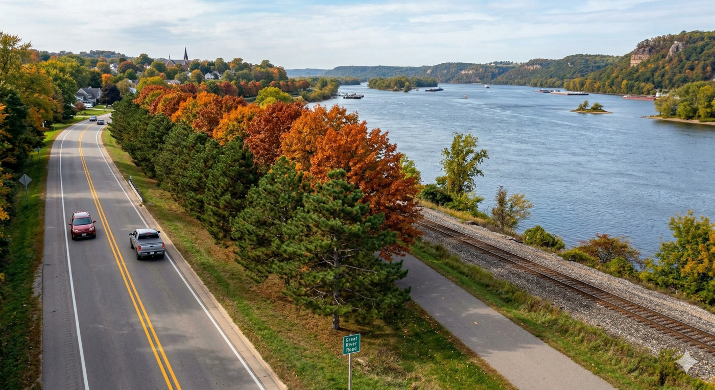
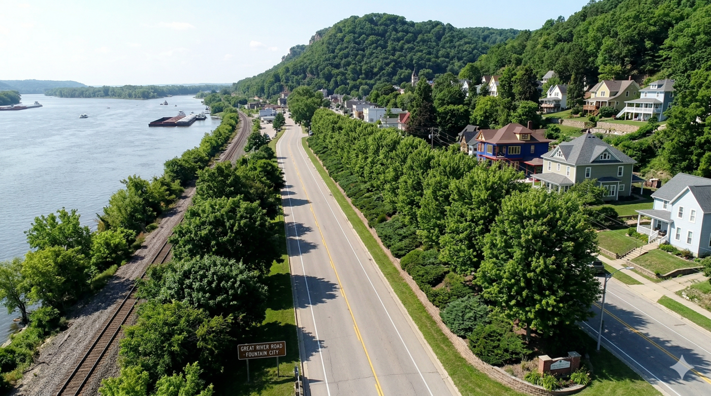
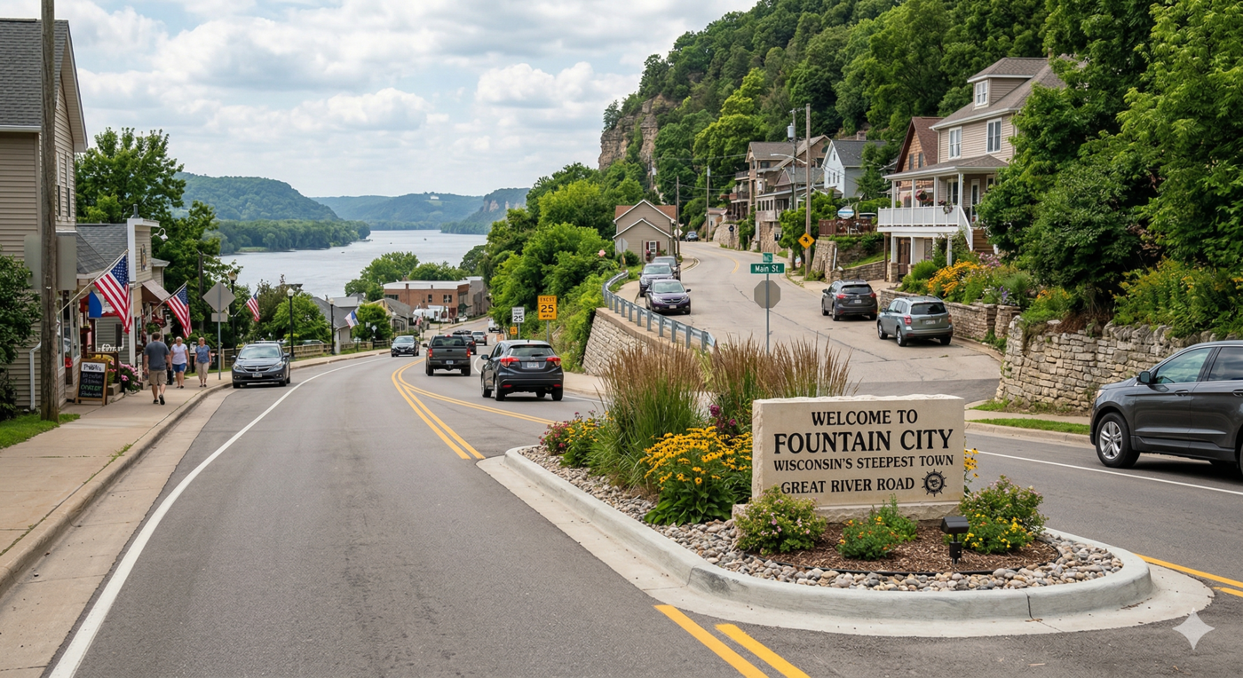
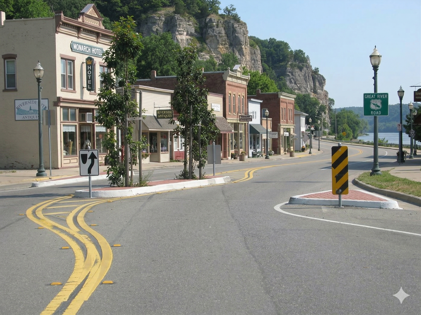
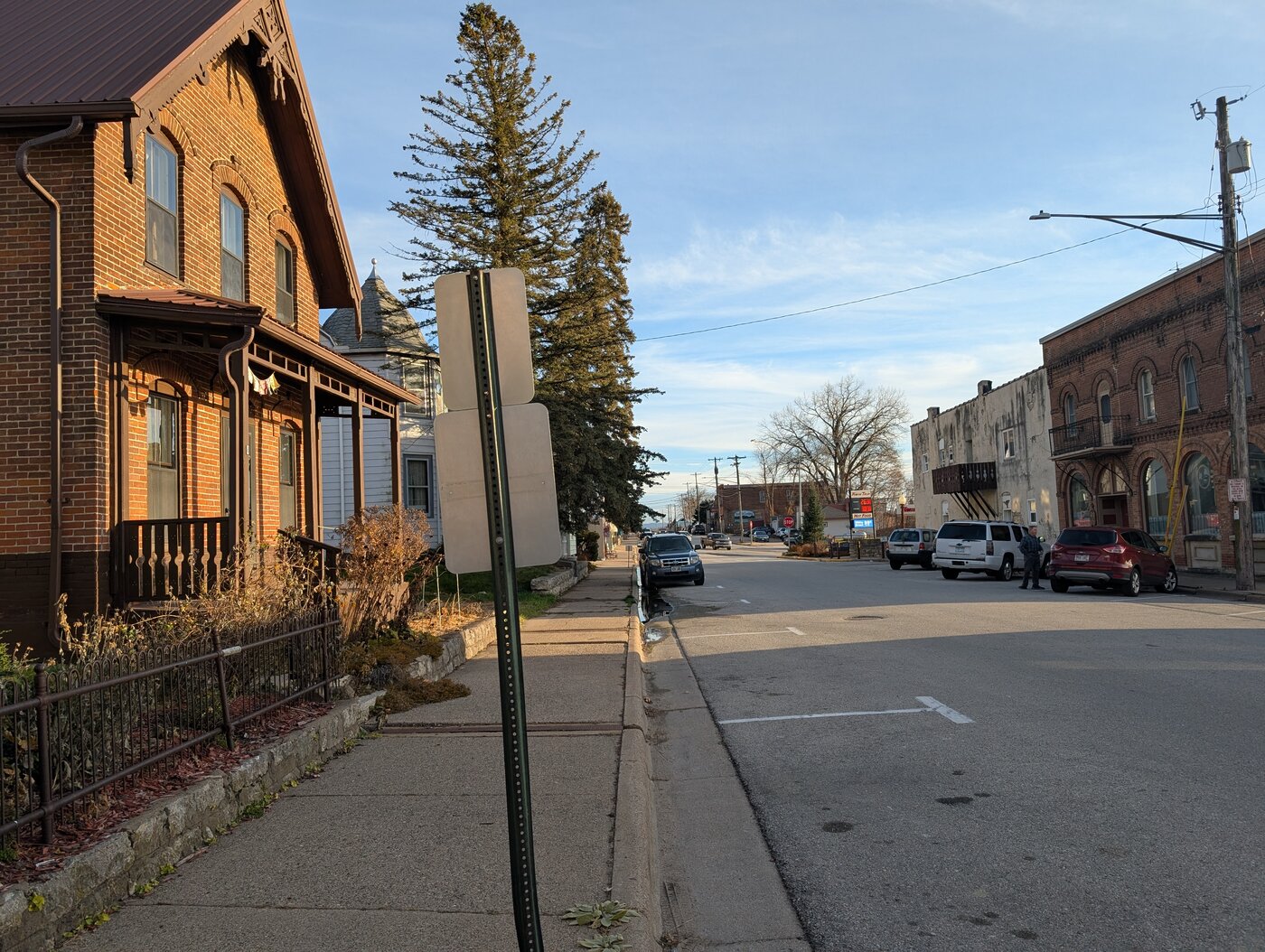
Fountain City is a small city of approximately 800 residents situated along the Mississippi River in Buffalo County, Wisconsin. The city is flanked by dramatic limestone bluffs to the east and the river to the west, giving it a distinct natural character that is central to its identity. The Great River Road—a national scenic byway—passes directly through downtown, connecting the city to surrounding communities including Winona, Minnesota to the south and Merrick State Park to the north. Despite its scenic location and natural assets, Fountain City faces challenges common to many small river towns, and community members have identified a range of opportunities to strengthen public space, improve connectedness, and build on the city’s natural and cultural assets. This report presents a community-driven vision for doing so, developed in partnership with local stakeholders and grounded in direct community input.
3 Community feedback
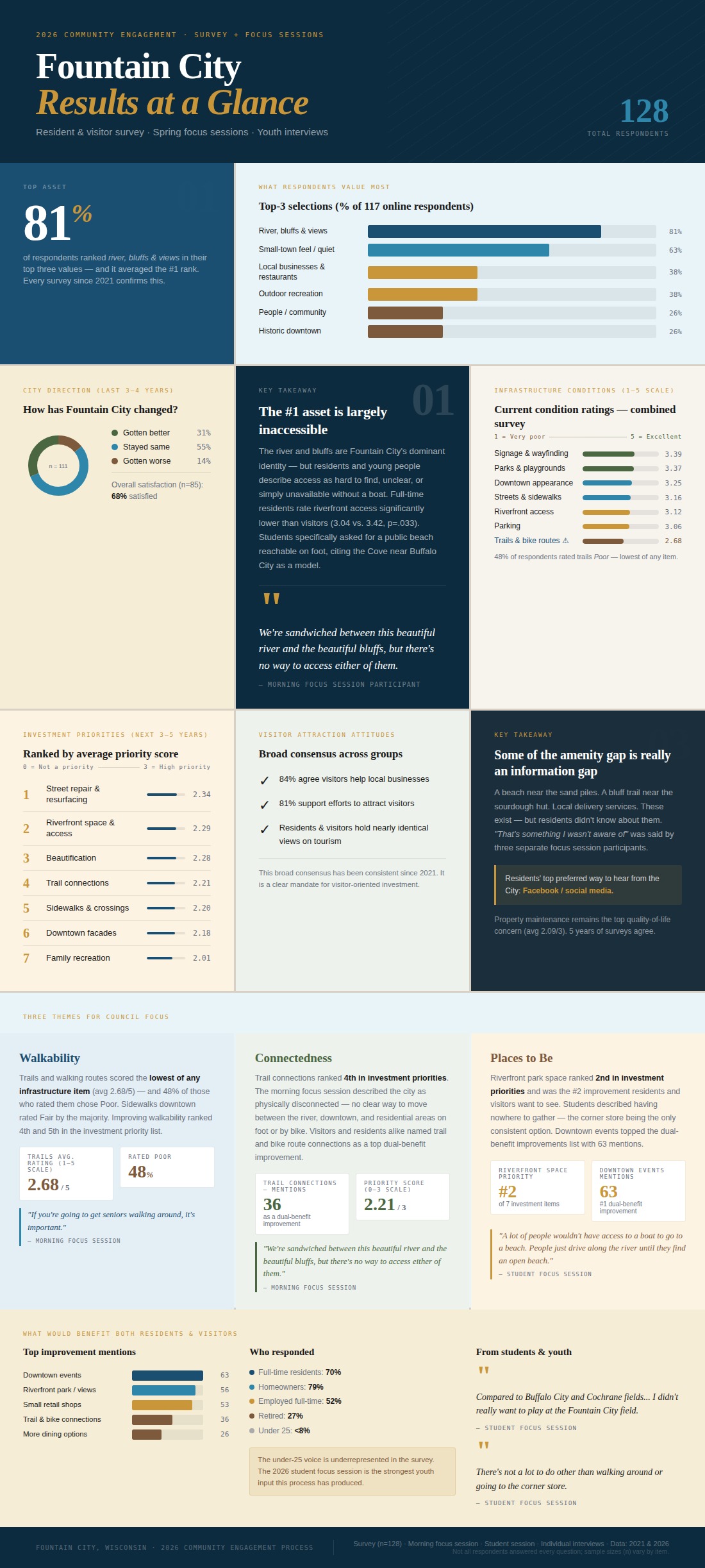
Community input was gathered through several methods: a survey distributed in early 2026 that received 128 responses (offered both online and on paper to reach a broad cross-section of residents), two focus sessions held in spring 2026 (one with community members and business owners and one specifically with students), individual interviews conducted via Zoom for those who could not attend the larger in-person focus sessions, and informal feedback gathered from local businesses by city council members. Together, these efforts captured perspectives from full-time residents, visitors, business owners, and young people. A full summary of survey and focus session findings is available in the accompanying data report.
3.1 What residents value most
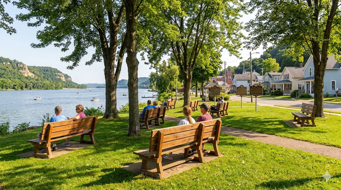
When asked to identify their top three things about Fountain City, respondents were remarkably consistent. The river, bluffs, and views were selected by 81% of respondents and ranked first on average, making it the single most dominant finding in the survey. Small-town feel came in a clear second at 63%. The recommendations in this report are built around protecting and activating what residents already love most about their community.
3.2 Current conditions
Overall satisfaction with Fountain City is high, with 68% of survey respondents saying they were satisfied. A majority (55%) felt the city has stayed stable over the last several years, 31% felt it has improved, and 14% felt it has gotten worse. Among those who said worse, open-ended responses centered on property conditions, loss of amenities, and a perceived decline in community spirit.
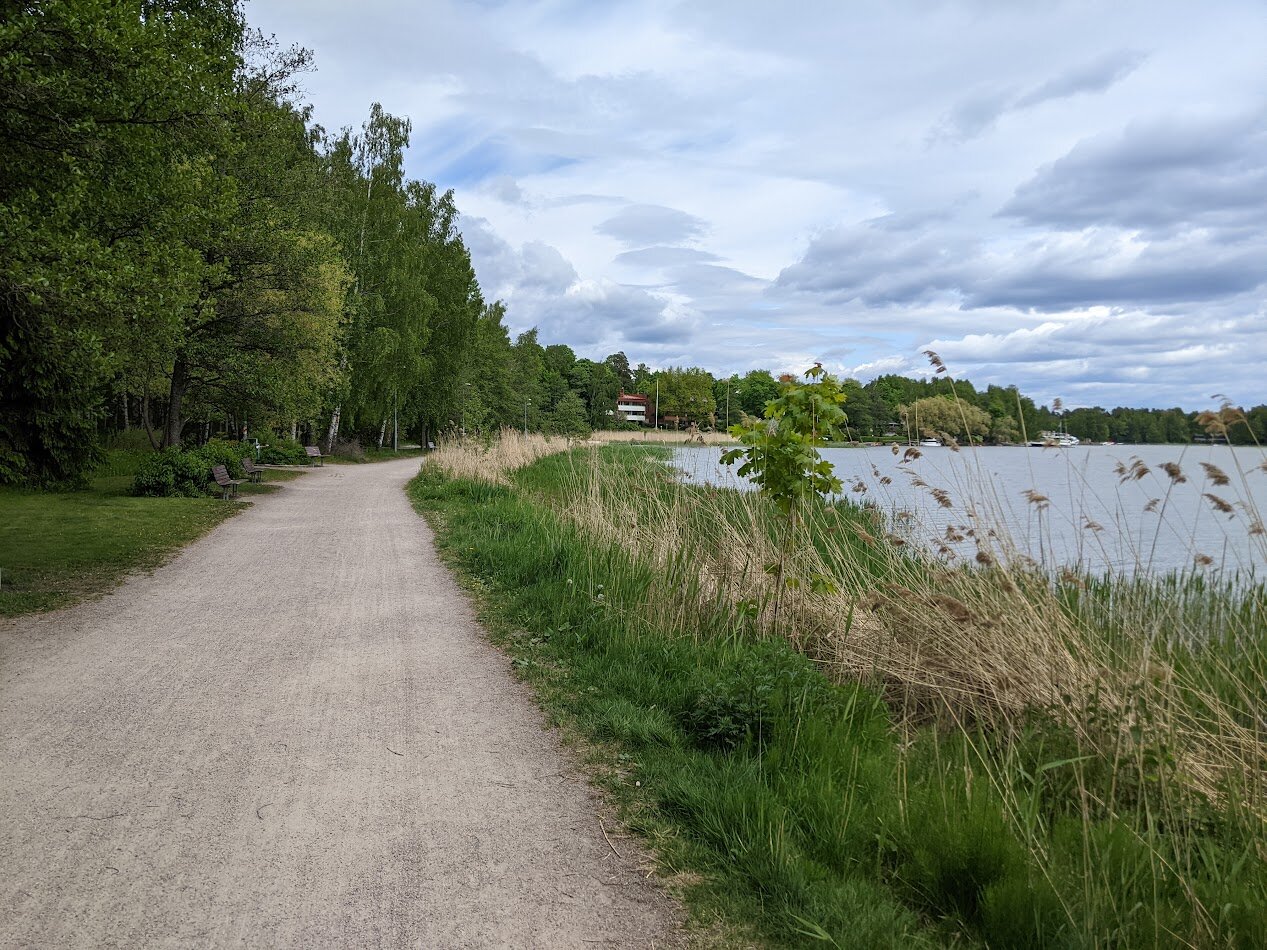
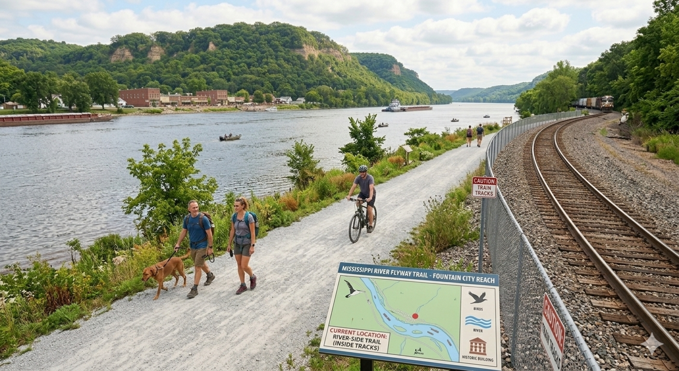
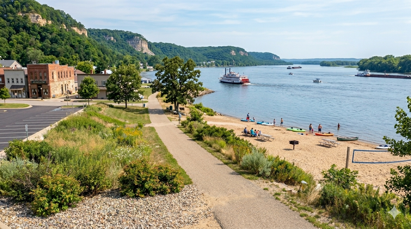
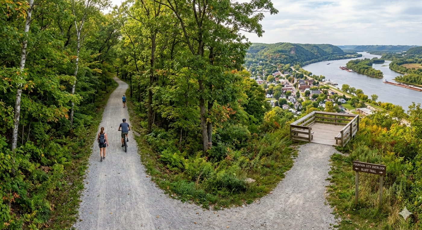
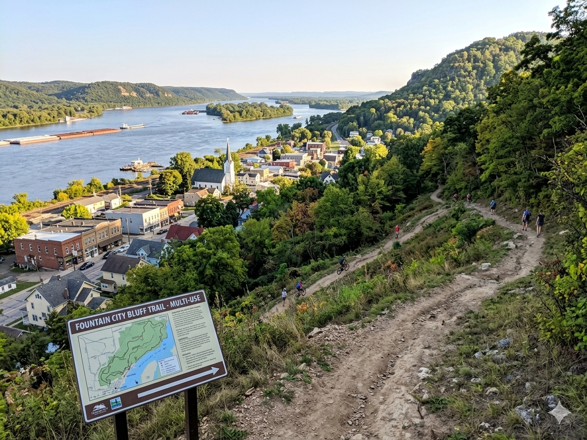
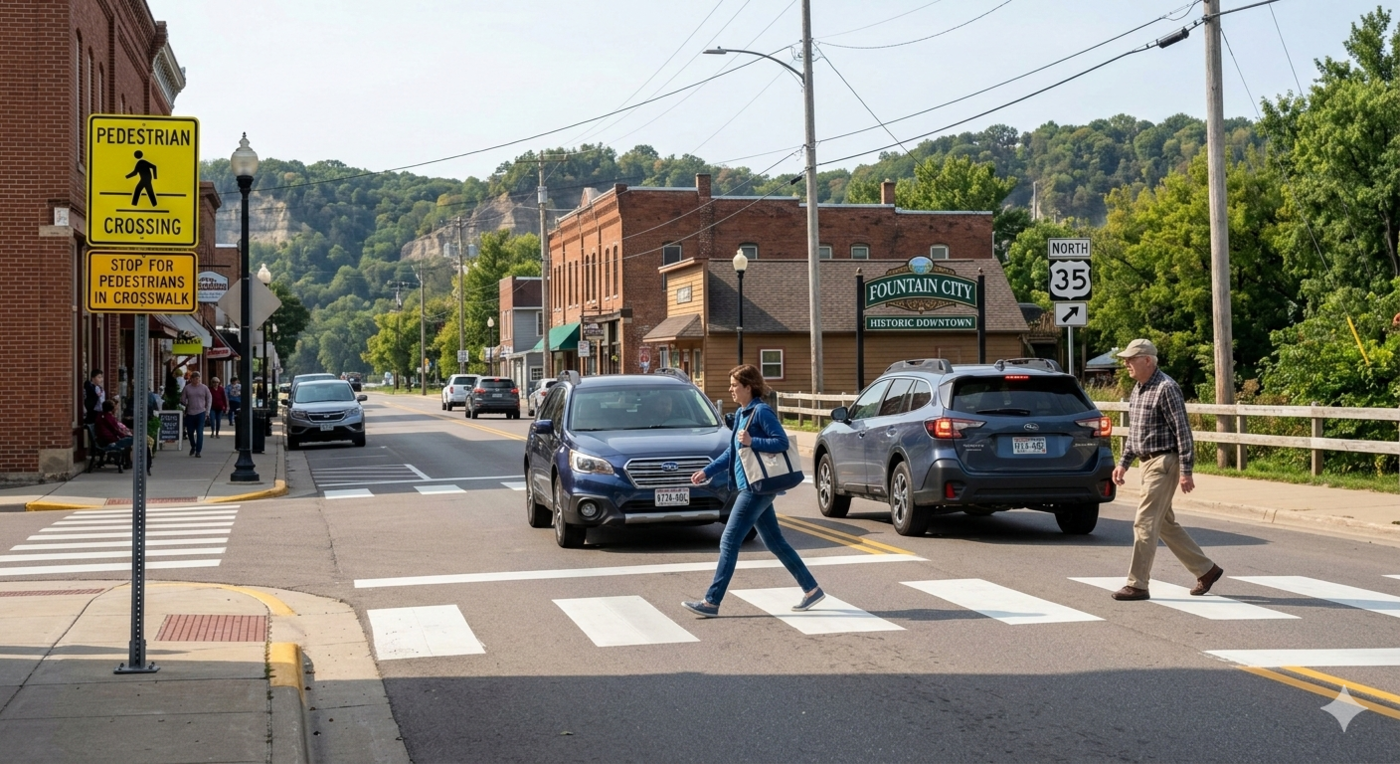
Beneath that broad satisfaction, two infrastructure gaps stand out. Trails and walking routes scored the lowest of any infrastructure category, with an average rating of 2.68 out of 5, and nearly half of respondents rated them Poor. Riverfront access was the most divisive item, with full-time residents rating it significantly lower than visitors, consistent with people who interact with it daily feeling its limitations more acutely. The morning focus session put it plainly: “We’re sandwiched between this beautiful river and the beautiful bluffs, but there’s no way to access either of them.”
A related finding: some of Fountain City’s best assets (a beach near the sand piles, a bluff trail accessible from the south end of town) are unknown even to longtime residents. Part of what looks like an amenity gap is actually a communication gap, one that better signage, maps, and a simple visitor guide could begin to address at low cost.
3.3 What residents want to see next
When asked to rate investment priorities for the next three to five years, street repair and improved public riverfront space scored highest, with beautification and trail connections close behind.
| Investment Priority | Avg. Score (0–3; high score means greater priority needed) |
|---|---|
| Repairing and resurfacing key streets | 2.34 |
| Creating or improving public riverfront space | 2.29 |
| Beautification (trees, planters, lighting, art) | 2.28 |
| Trail connections (walking/biking routes) | 2.21 |
| Improving sidewalks and safer street crossings | 2.20 |
| Downtown facade improvements | 2.18 |
| Adding family recreation (playgrounds, splash pad) | 2.01 |
Support for visitor-oriented investment was broad and consistent: 84% of respondents agreed that visitors help local businesses, and 81% supported efforts to attract more visitors.
3.4 Three themes
Taken together, the data points toward three organizing themes that run through the recommendations in this report. The first is walkability: trails and walking routes are the lowest-rated infrastructure item in the survey, and improving pedestrian connectivity is a consistent priority across age groups. The second is connectedness: residents describe the city as physically disconnected, with no clear way to move between the river, downtown, and residential areas on foot or by bike. The third is places to be: riverfront park space ranked second among investment priorities, downtown events topped the list of improvements that would benefit both residents and visitors, and students described having almost nowhere to gather in town.
3.5 The youth voice
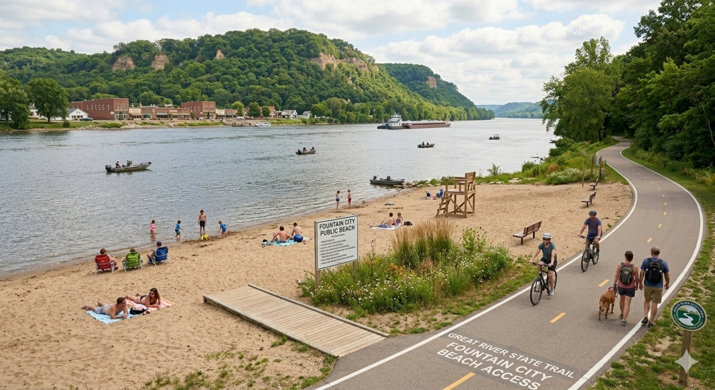
The student focus session produced some of the most specific and consistent feedback in this process. Teenagers described a community where there is almost nowhere to go, with the Corner Store being the only place they named as somewhere they actually spend time. They described the river as the community’s greatest asset and, without a boat, effectively off-limits. They asked specifically for a public beach reachable on foot. As one student put it: “There’s not a lot to do other than walking around or going to the Corner Store.”
Because young people were underrepresented in the broader survey sample (fewer than 10% of respondents were under 25), the student session represents the clearest window into what Fountain City’s next generation needs from its public spaces.
3.6 From input to action
These findings are consistent across age groups, tenure, and engagement format. Residents and visitors alike value the natural setting above all else, notice the gaps in trail connectivity and riverfront access most acutely, and broadly support investment in the public realm. The recommendations that follow are grounded in that input, designed to address the community’s most clearly stated needs while building on the assets that make Fountain City worth investing in.
3.7 Graphical results and full report
A full report describing the results of the surveys and focus groups can be found here, and a graphical summary that was shared previously with the community is available below.
4 Overarching principles
The recommendations in this report have several overarching principles based on community feedback and best practices from the field of urban and regional planning.
Incremental development — Rather than pursuing large capital projects that strain municipal finances and require years of planning, the city should prioritize small, achievable improvements that can be implemented quickly and built upon over time. Early wins build public confidence in the planning process, demonstrate results to funders, and create momentum for more ambitious projects down the road.
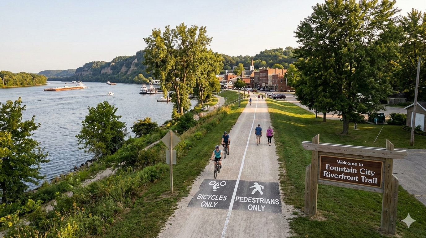
Connectedness via local and regional trail systems — Community feedback consistently identified a lack of pedestrian and non-motorized transportation connections as a significant gap. This report places strong emphasis on trail connectivity, with proposed improvements strategically located along a new local and regional trail system. Connecting neighborhoods, parks, the riverfront, and the downtown through a coherent trail network would reduce car dependence and open up new recreational possibilities for residents and visitors alike.
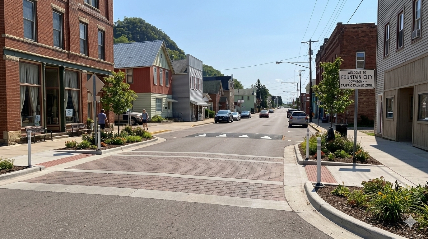
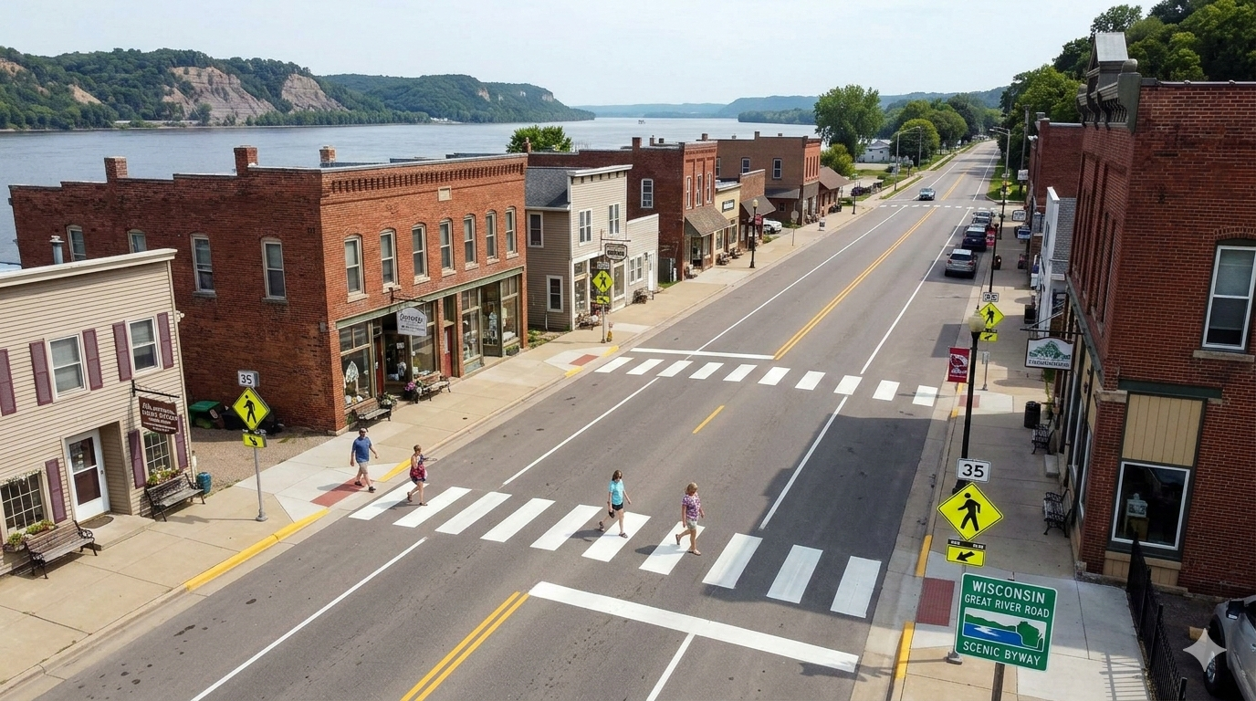
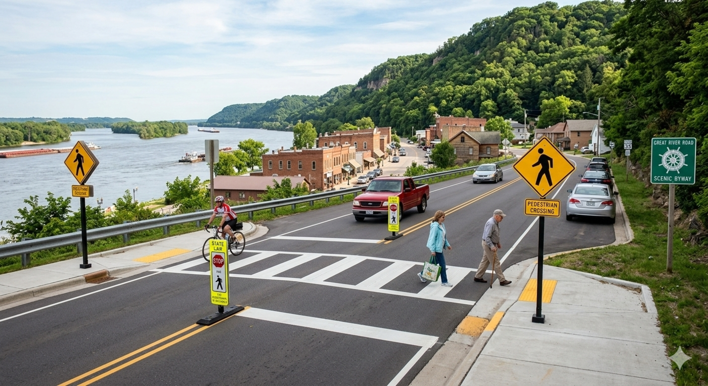
Traffic calming and walkability — Slowing vehicle traffic and making streets more comfortable for pedestrians is both a quality-of-life and an economic development strategy. Walkable downtowns support local businesses, attract visitors, and make communities more desirable places to live. Investments in traffic calming also improve safety and reduce the likelihood of serious injuries at vehicle-pedestrian conflict points.
Low-maintenance solutions — Fountain City’s public spaces are largely cared for by a small group of dedicated volunteers and city staff who are already stretched thin. The city should prioritize improvements that require minimal ongoing upkeep and avoid solutions that add new maintenance burdens. Designs that are durable, simple, and easy for community members to care for are strongly preferred.
Presence of people — Public spaces that attract people create a virtuous cycle: active spaces feel safer, draw more users, and support nearby businesses. Designing spaces that invite people to linger—through seating, shade, programming, and interesting things to observe—generates the kind of foot traffic that benefits the entire downtown.
Reinforcing land uses — Proposed improvements should be evaluated in the context of their surroundings rather than as isolated interventions. The most effective public space investments connect to and strengthen adjacent land uses. A bluff trail, for example, is most valuable when connected to downtown; a community garden is more impactful when placed along a trail or adjacent to a park. This principle encourages thinking about each project as part of a larger, interconnected system.
This report presents a range of implementation options, from near-term quick wins to longer-horizon infrastructure investments. Many suggestions include design alternatives to give the city flexibility in responding to available funding and local priorities. Across all of these recommendations, the city should be committed to fiscal responsibility and to pursuing meaningful improvements without placing undue burden on local taxpayers. Grant programs and philanthropic funding should be pursued proactively and systematically, with grant-writing treated as an ongoing organizational priority rather than a project-by-project afterthought.
5 Project suggestions: Quick wins
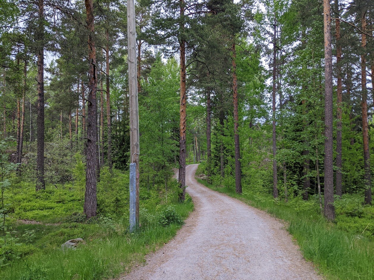
5.1 Prioritize trail connections
The proposed trail system starts from downtown Fountain City and extends outward in both directions, ultimately connecting to Merrick State Park to the north and the Flyway Trail near the Winona Bridge to the south. The system is organized into five phases, each building on the previous to extend connectivity throughout and beyond the city. Several phases include alternative route options—an eastern and western branch—to preserve flexibility depending on right-of-way availability and funding. The overview map below shows all five phases; detailed maps for each phase appear in the sections that follow.
5.1.1 Phase 1 - Downtown boardwalk
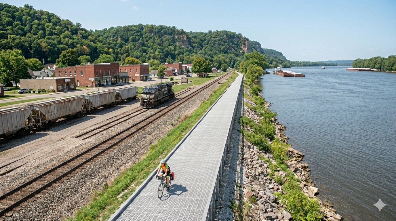
Phase 1 establishes the foundational spine of the trail system, running along the western side of the railroad right-of-way between the boat landing near Liberty Street and the upper docks near North Street. This segment hugs the river and connects two of the downtown’s most important waterfront access points, creating a continuous pedestrian and bicycle route through the heart of Fountain City’s riverfront. At key intersections, the trail will extend to connect with the Great River Road, giving users safe crossings between the waterfront path and the downtown street grid.
Because this segment runs through a low-lying area adjacent to the river, a raised boardwalk design is recommended. Elevating the trail above the floodplain would protect the infrastructure from seasonal flooding, extend its useful life, and create a visually distinctive feature that signals the trail’s presence to people approaching from the street. This type of construction has been used successfully in similar river town settings and is well-suited to Fountain City’s waterfront conditions. The newly constructed boardwalk along the St. Croix River in Stillwater, Minnesota could be used as a model this type of infrastructure.
5.1.2 Phase 2 - Downtown Spur and extensions from downtown
Phase 2 is composed of three connected segments: a northern extension, a southern extension, and a Downtown Spur that links the trail to the commercial core. Together, these segments begin to create a navigable network for pedestrians and cyclists moving through and around downtown Fountain City.
The Downtown Spur is the most strategically important piece of this phase. It runs north along South Main Street to North Street, then west to North Shore Drive, then south back to Liberty Street—forming a loop through the downtown that puts key businesses, civic facilities, and points of interest within easy walking distance of the trail. This loop transforms the trail from a linear route into a connected loop that visitors can use to explore the entire downtown without needing to drive.
The northern extension runs along the inside of the railroad tracks, where available right-of-way is more suitable than the outside. It continues northward until the Great River Road bends near the US Army Corps of Engineers Service Base, at which point a crosswalk is needed to transition the trail across the highway. The southern extension offers two route choices: a western branch following the inside of the railroad tracks toward Spring Street, and an eastern branch that runs along the highway corridor from Liberty Street to Spring Street. These alternatives give the city flexibility in right-of-way negotiations and allow the more feasible option to be built first.
5.1.3 Phase 3 - Southern extension
Phase 3 extends the trail southward from downtown to Fountain City Community Park, the city’s primary green space. Like Phase 2, this segment offers a choice between a western branch—which stays close to the river by following the inside of the railroad tracks until it reaches Mill Street—and an eastern branch, which follows Park Road and provides a more accessible, street-adjacent route for users who prefer a flatter and more visible alignment. The western branch prioritizes the riverfront experience; the eastern branch makes better use of existing infrastructure and may be easier to develop given current right-of-way conditions.
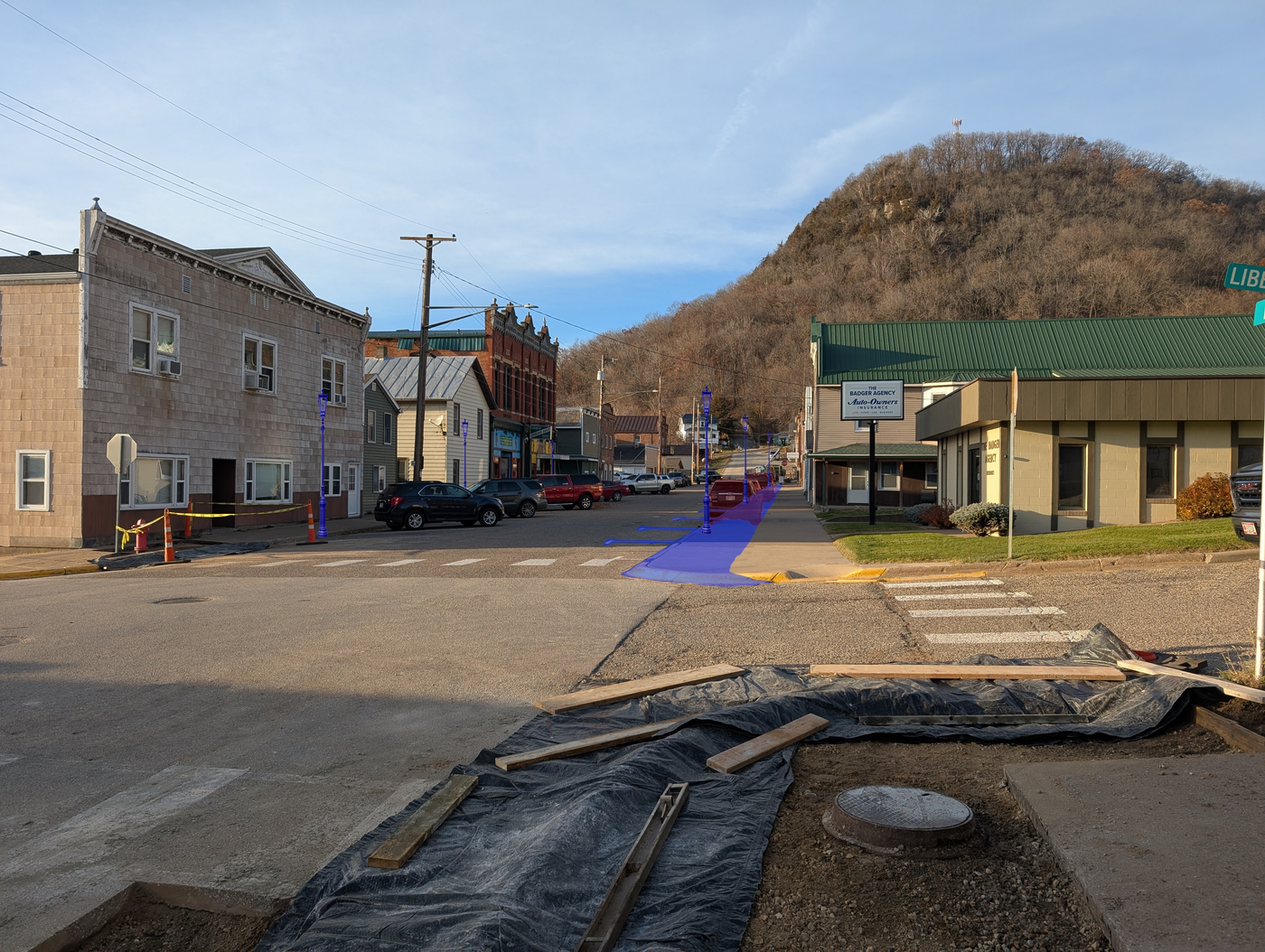
The two branches converge at Mill Street before crossing to the Great River Road. Crosswalks should be installed at each point where a branch intersects with Mill Street, and at the Mill Street and Great River Road intersection. These crossings are essential for safety—they formalize the connection between the trail and the park, reduce the hazard of informal crossings, and provide an opportunity to introduce visible pavement treatments that slow traffic through this portion of the highway corridor.
5.1.4 Phase 4 - Merrick State Park connection
Phase 4 establishes Fountain City’s first direct regional trail connection, extending northward from the crosswalk at the end of Phase 2’s northern extension toward Merrick State Park. The trail initially follows the inside of the Great River Road before reaching a second highway crossing where the railroad diverges from the road. From there, the trail splits into two options: a northern branch that continues along the outer edge of the Great River Road until it diverts along Waumaundee Creek Rd (then back toward the park opposite of Park Street), and a southern branch that heads toward the river and connects to the southernmost campground loop. The western branch crosses low, wetland-like terrain and would require a boardwalk section similar in character to Phase 1.
Completing this phase would be a significant milestone for Fountain City. Merrick State Park draws campers, day visitors, and cyclists from across the region, and a direct trail connection would allow park visitors to travel into the city by foot or bike to visit restaurants, shops, and the waterfront. It would also position Fountain City as a waypoint on an emerging regional trail corridor and open the door to collaborative programming and marketing with the state park.
5.1.5 Phase 5 - Flyway Trail connection
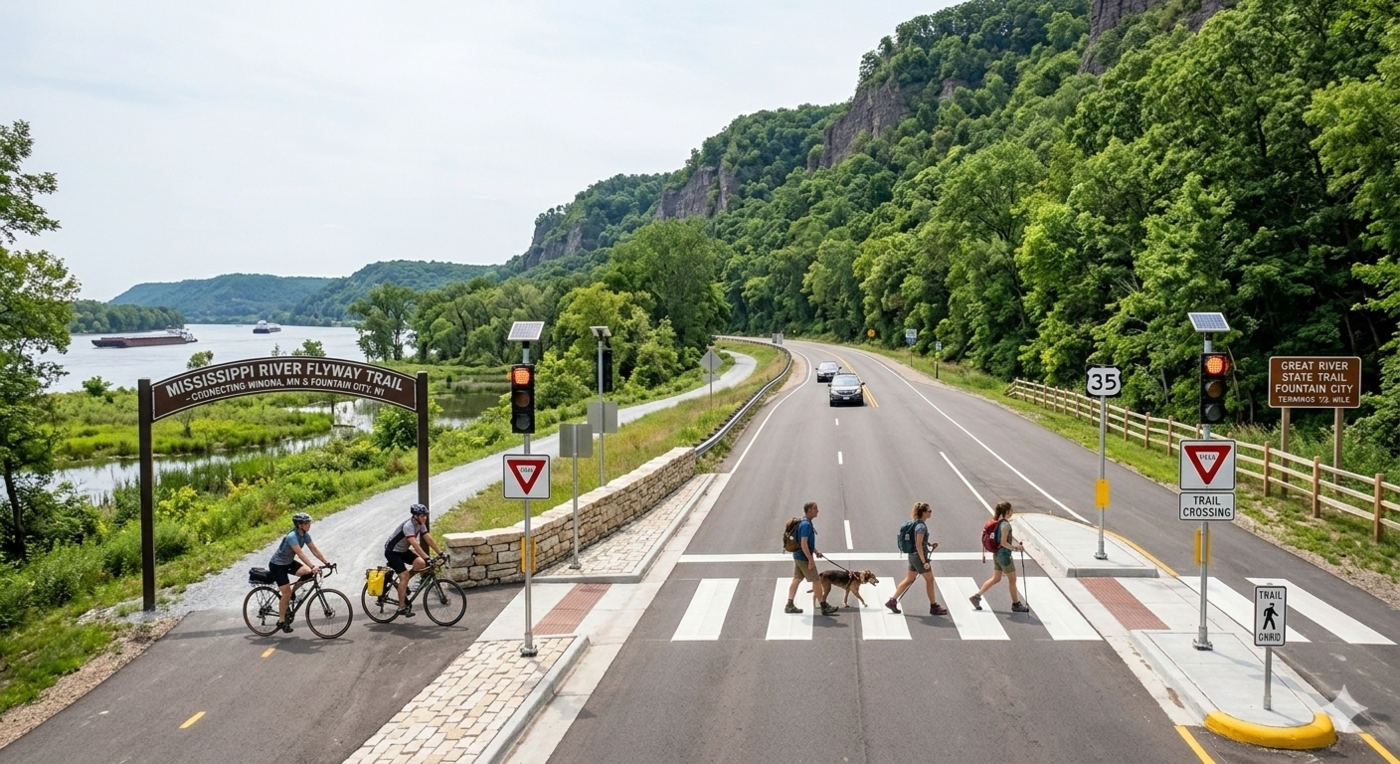
Phase 5 picks up from the Mill Street crossings established at the end of Phase 3 and extends the trail south toward the Winona Bridge and an eventual connection with the existing Flyway Trail. Completing this phase would allow cyclists and pedestrians to travel between Fountain City and Winona, Minnesota—a distance of roughly eleven miles—and link Fountain City to a broader regional cycling network along the Mississippi River corridor.
Two route options are proposed. The eastern branch follows the inside of the Great River Road for most of its length; the western branch tracks along the railroad corridor. Both terminate near the Winona Bridge approach. Right-of-way along the highway is constrained in several places, and the railroad alignment may ultimately prove more practical given available space. Coordination with WisDOT and the railroad will be essential in determining which route is feasible, what design treatments are appropriate, and what permitting or easement agreements would be required.
5.1.6 Future trail/route implementations
A connection to Sleepy Hollow Campground via county roads—including Waumandee Creek Road and Lower Eagle Valley Road—would extend the trail network into the surrounding hills and provide an additional access point to Fountain City for cyclists approaching from the east. Rather than a fully separated trail, this route would run along existing low-traffic roadways, keeping implementation costs modest. The connection would give campground visitors a direct bike route into the city and diversify the range of visitors who arrive by non-motorized means.
A hill climbing bike route from Waumandee Creek Road to Canada Ridge Road could offer an additional draw for more serious cyclists seeking elevation gain in the bluff country east of Fountain City.
As the trail network develops, a kiosk in the downtown could showcase recommended routes along with themed challenges such as “hit all the fountains” or “hike all the bluffs.” Participating businesses could sponsor trail passes that offer small rewards upon completion—a proven strategy for connecting trail use to downtown commerce. This type of programming tends to generate word-of-mouth among recreational visitors and can extend the city’s marketing reach well beyond its immediate area at very low cost.
5.2 Tap into community service
The city of Fountain City should encourage community members to take ownership of public space projects with guidance from elected officials. Volunteer stewardship programs have proven effective in small communities as a way to maintain parks, green spaces, and trail infrastructure without placing additional burden on limited city staff. The community service requirement at Cochrane-Fountain City High School could be leveraged to help maintain public spaces in Fountain City, giving students a tangible connection to their community and opportunities for meaningful civic engagement. Additionally, given the success of the historical society’s logo competition, similar design challenges could be organized for things like downtown sign production, mural concepts, or park branding—turning civic improvement projects into community events and fostering broader public investment in the city’s identity.
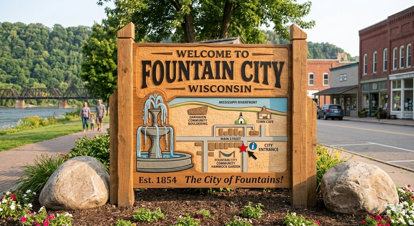
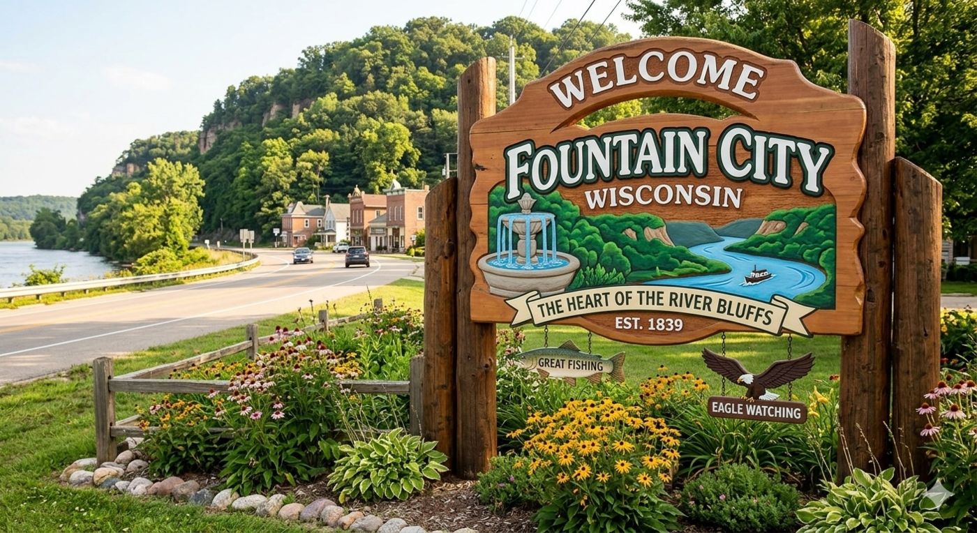
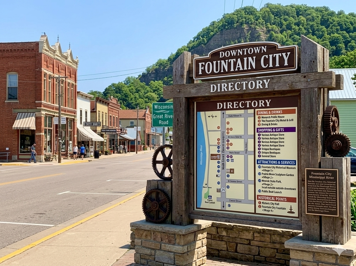
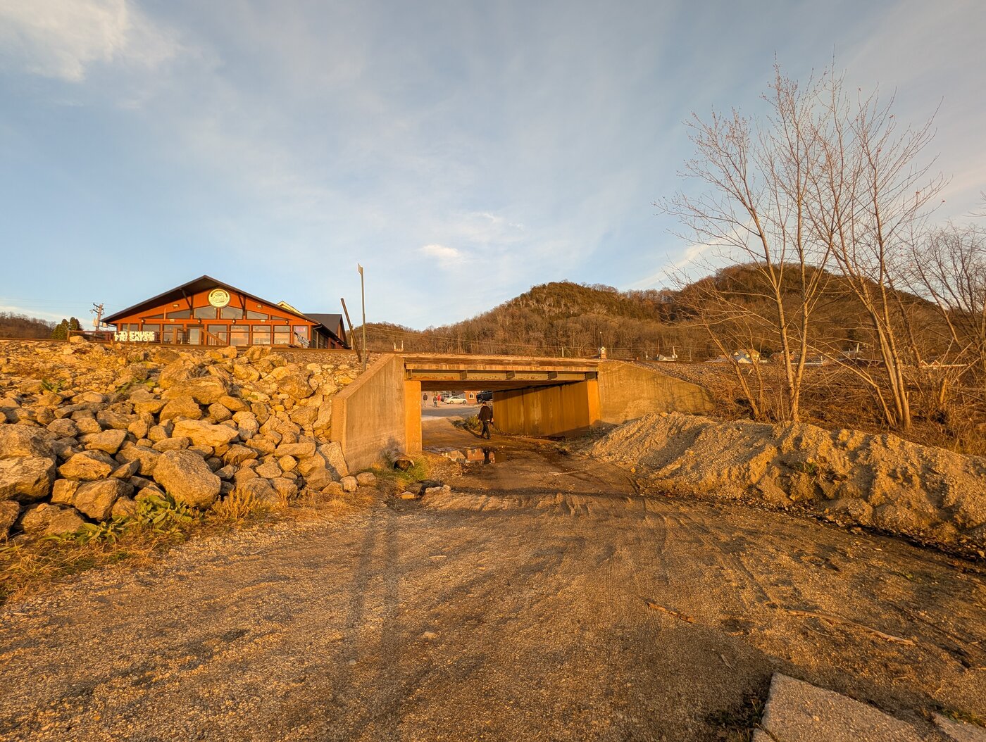
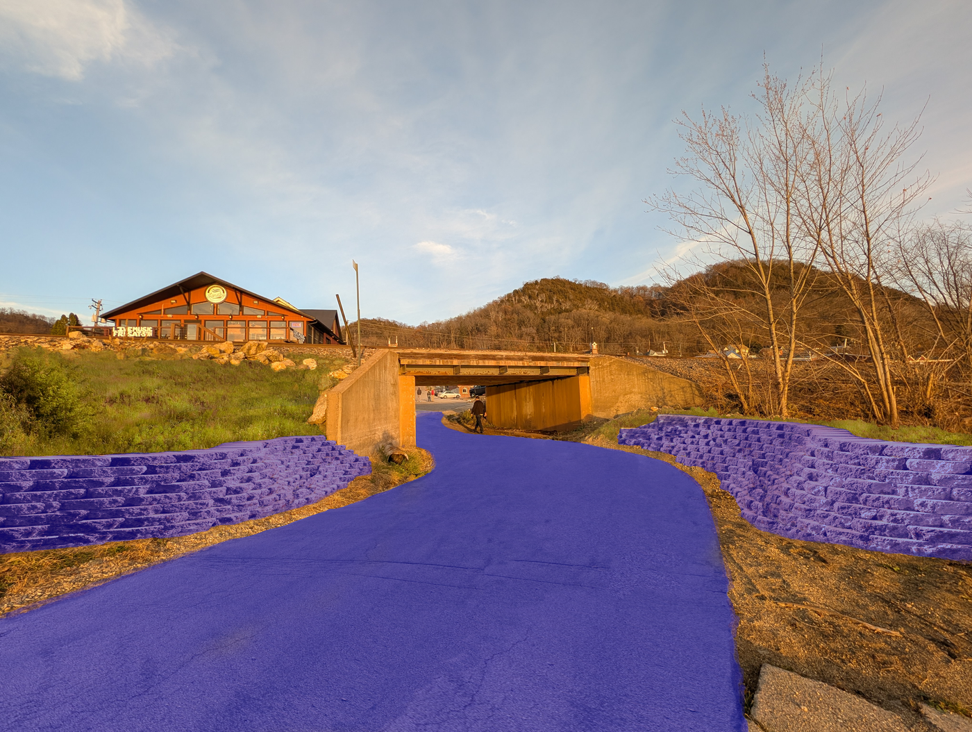
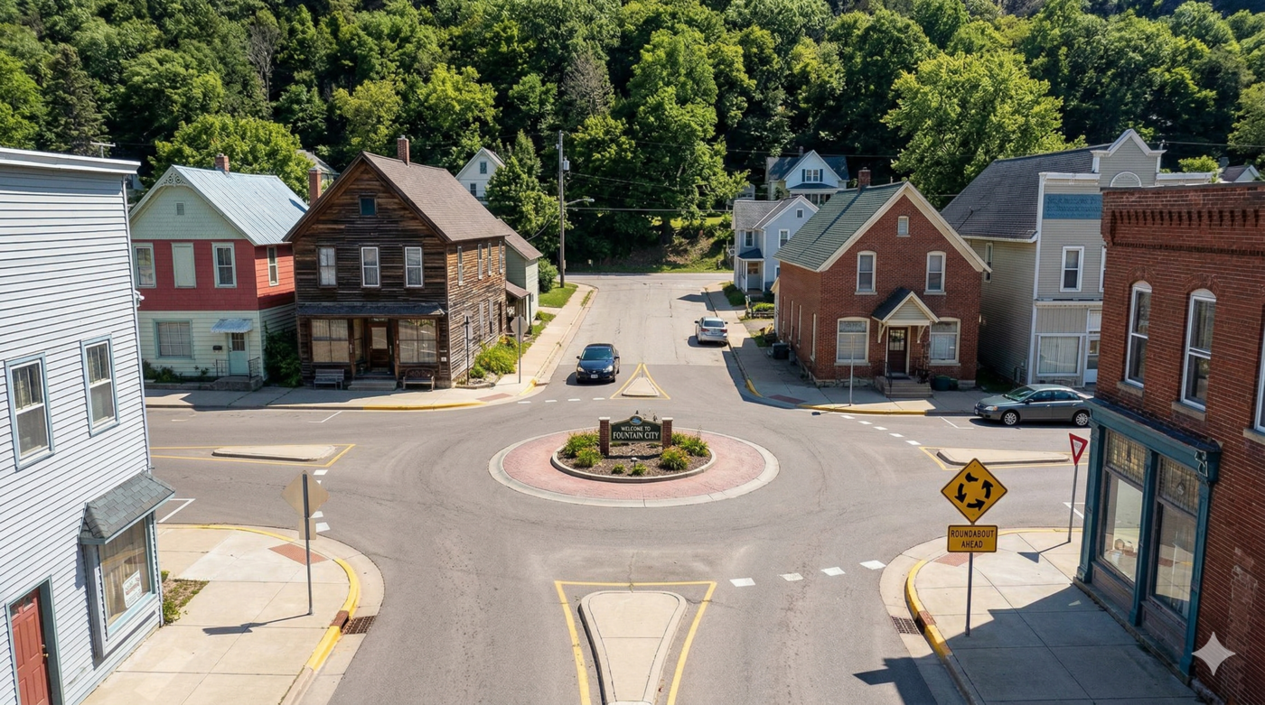
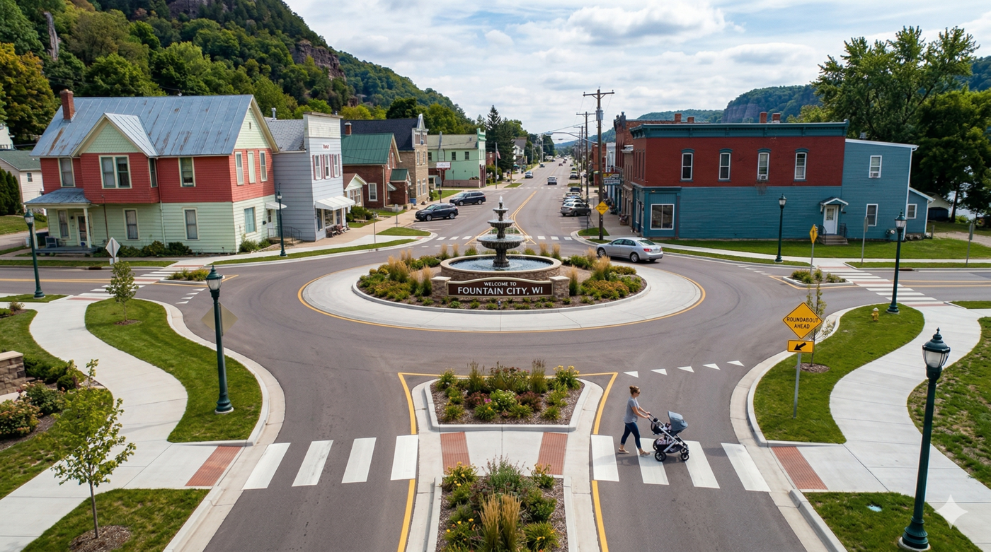
5.3 Improved signage: city entrances
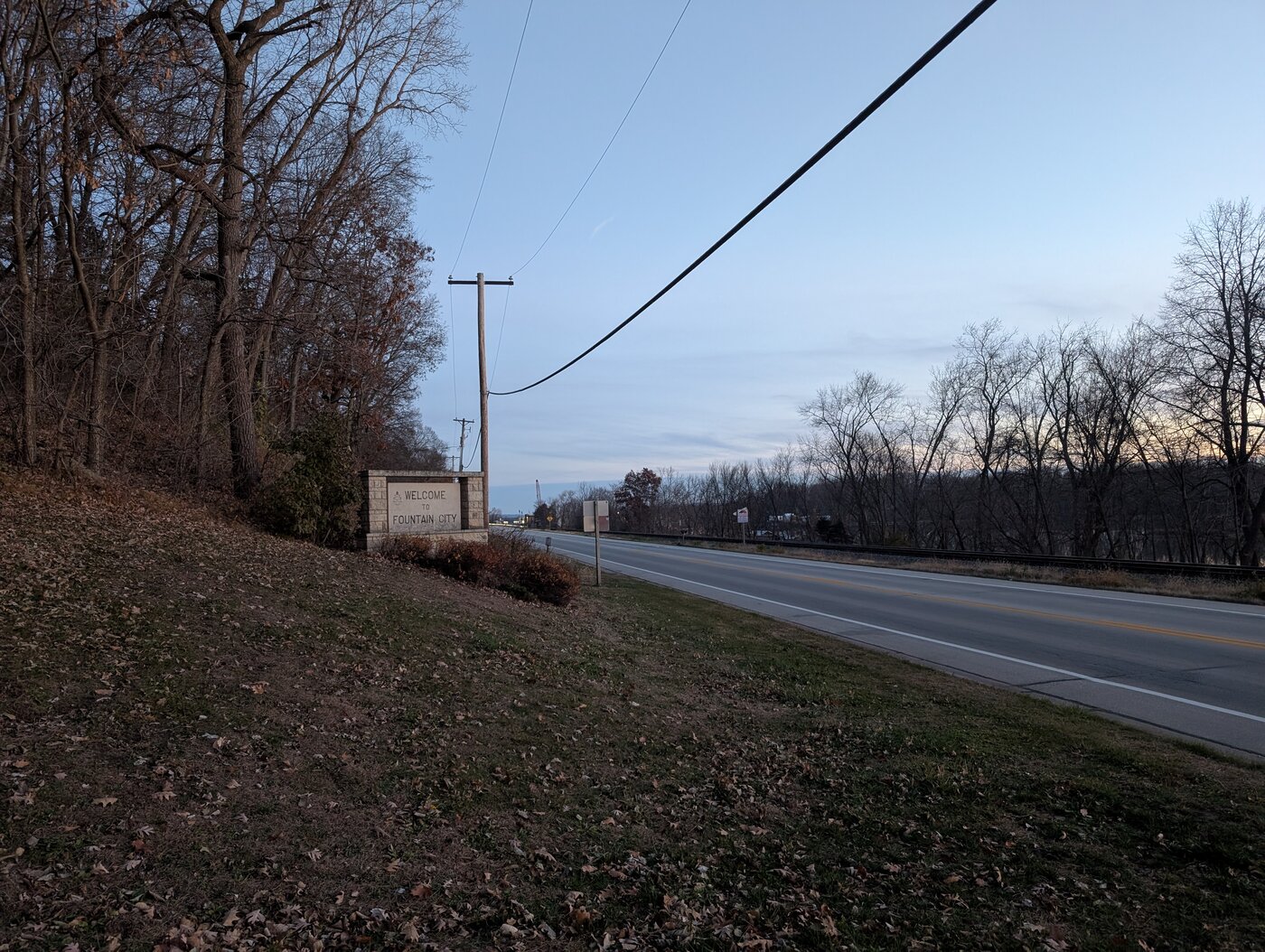
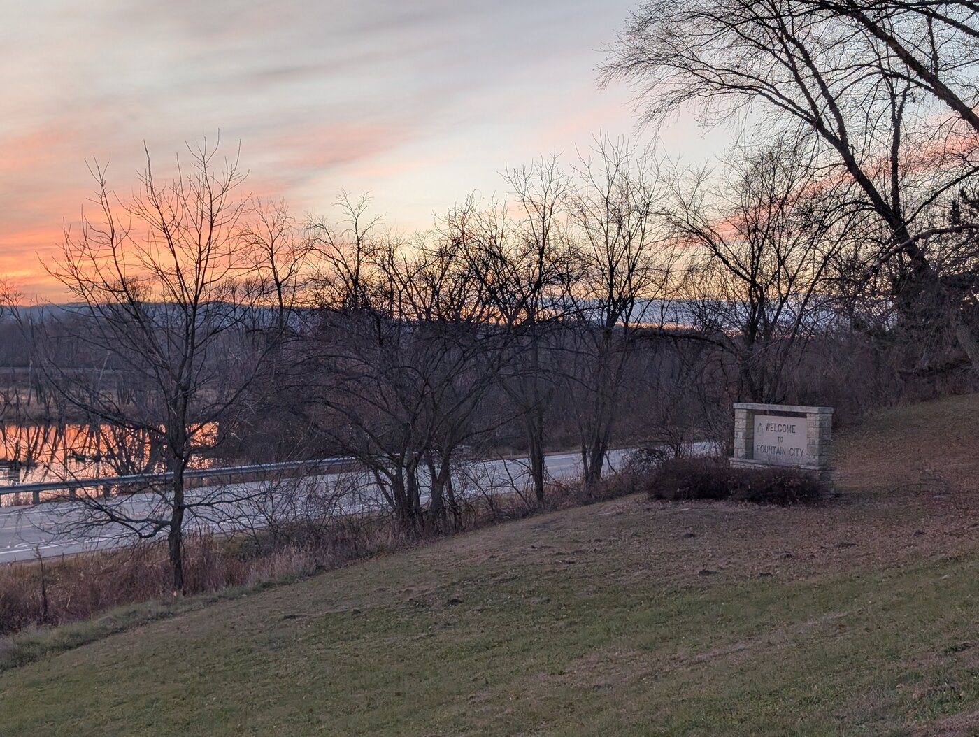
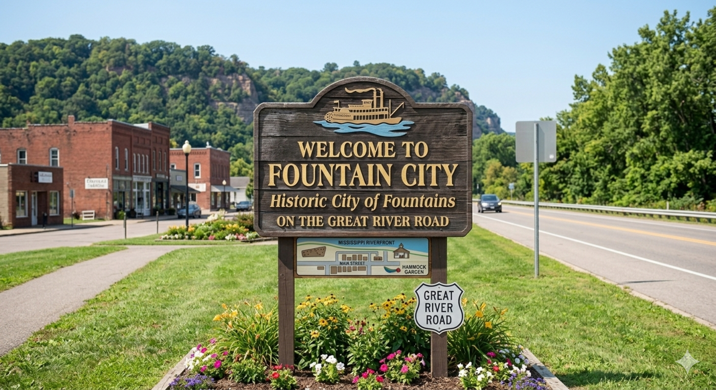
Signage where the city starts is important to make people “feel” like they are in Fountain City. Currently, signage is nice but difficult to notice—these signs are found at places where traffic speed is quite high and while they are within city limits, they are located quite a ways away from the core of town. Ideally, these should be located closer to core city functionality even if they are placed further within city limits. Moving or supplementing entrance signage closer to the downtown core would give the city a stronger sense of arrival and place. Adding color, landscaping, and lighting will help signage become more noticeable to drivers at highway speeds, especially for visitors unfamiliar with the city.
5.3.1 Current
5.3.2 Suggested implementations
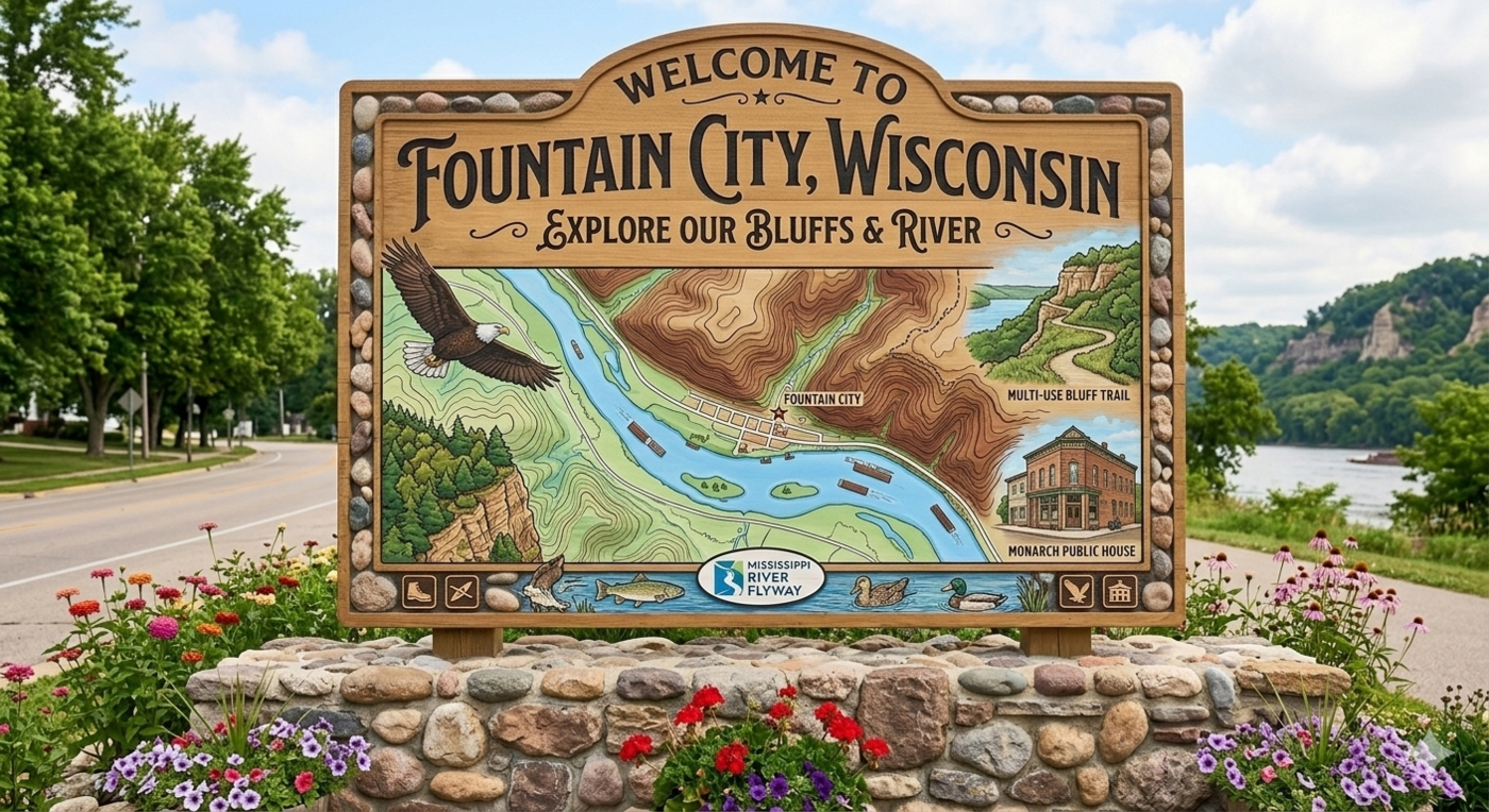
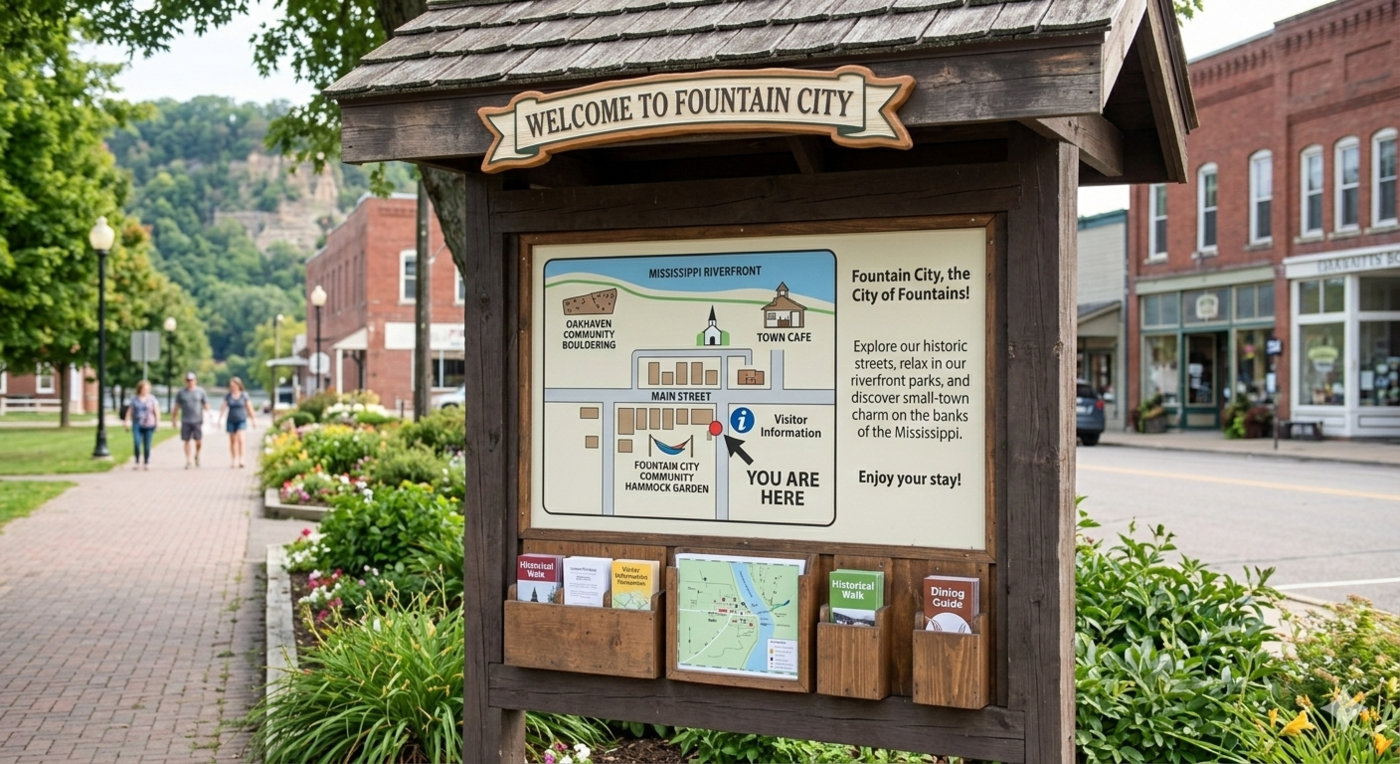
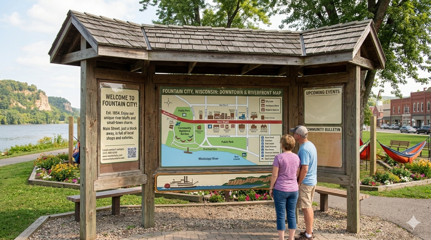
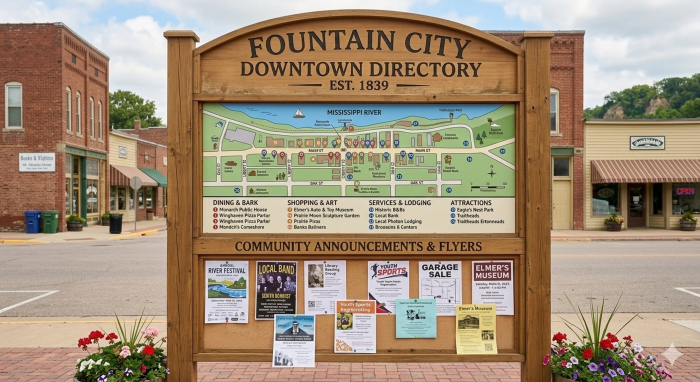
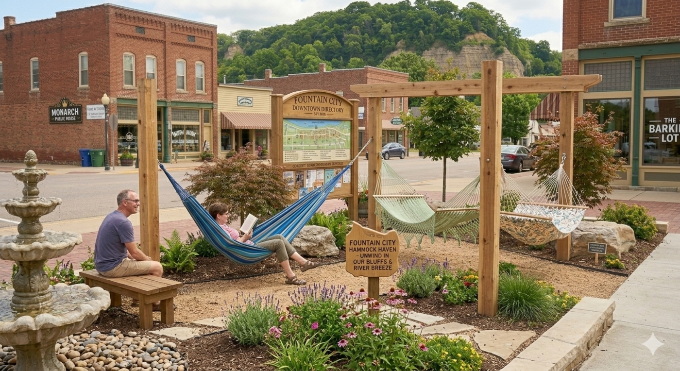
5.4 Improved signage: directory kiosks
A directory kiosk is a great way to help residents and visitors navigate Fountain City’s downtown and trail system. Kiosks could be funded creatively through sponsorships from the local businesses listed on them, making them a low-cost investment for the city with a built-in incentive for business participation. They should be placed at strategic locations along the Fountain City Trail and its Downtown Spur—including key parking areas, the docks, and boat launches—as well as at high-visibility gathering spots throughout the downtown core. In addition to wayfinding, kiosks could serve as a local bulletin board for events, seasonal programming, and points of interest, reinforcing the city’s identity and giving visitors a reason to explore further on foot.
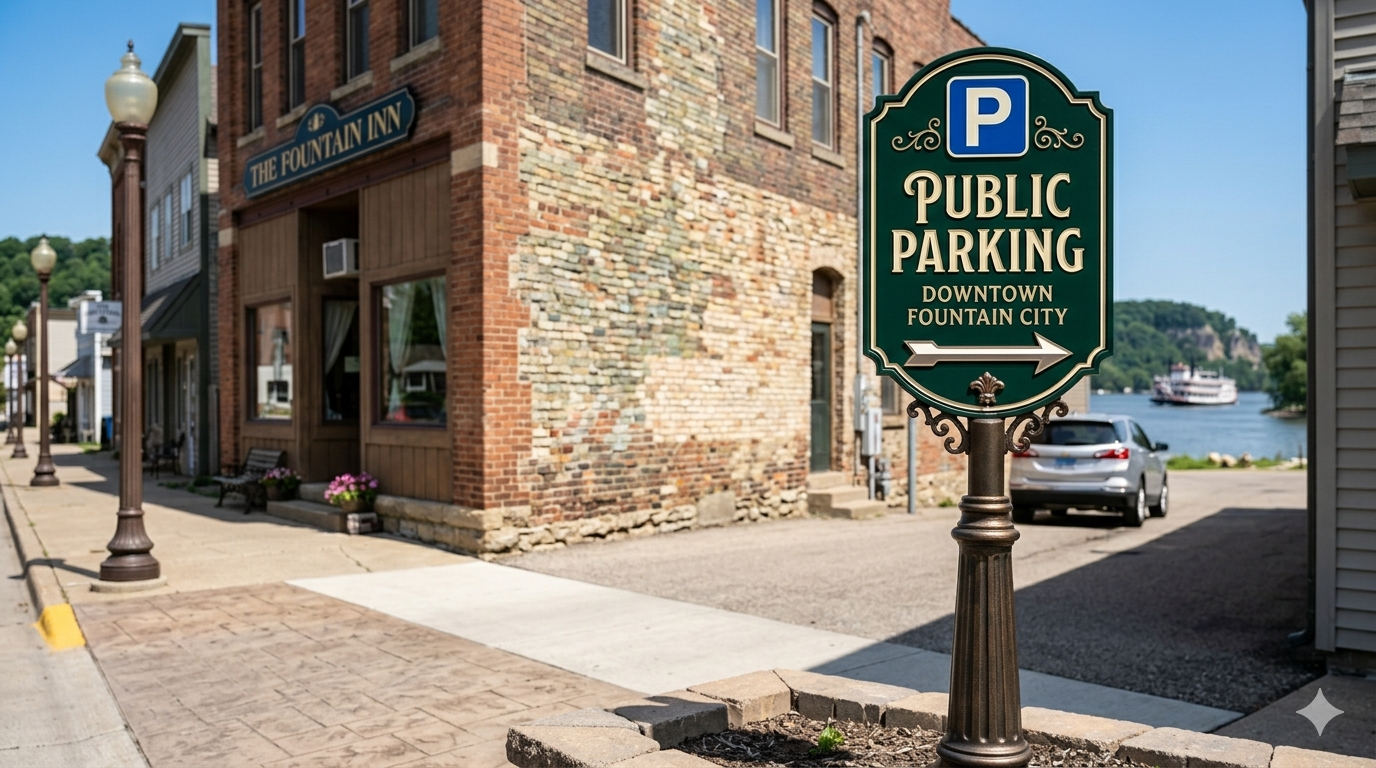
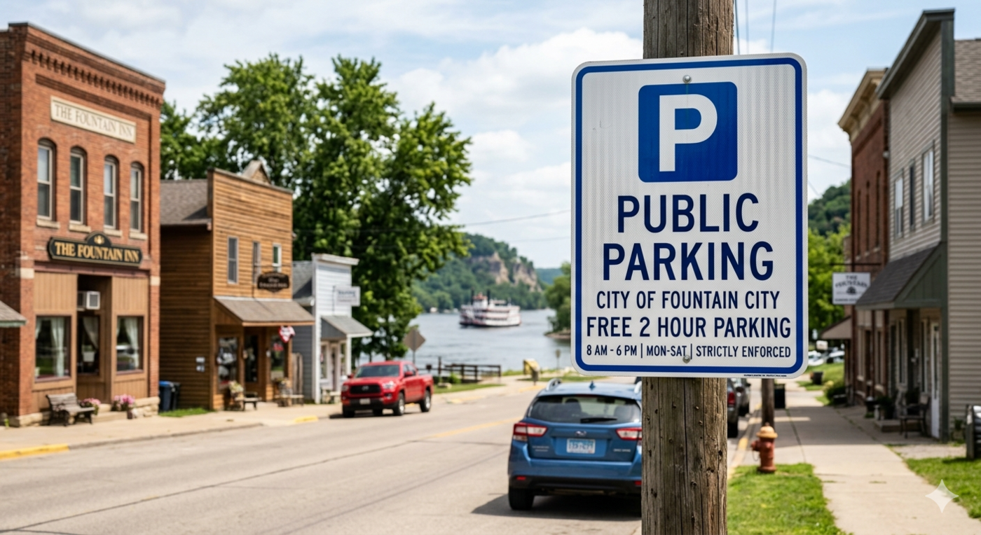
5.5 Improved signage: Parking
Residents and visitors have often commented that it isn’t clear where it is appropriate or legal to park in Fountain City. This ambiguity can frustrate visitors and discourage people from stopping, particularly those unfamiliar with the city. Clear, well-placed parking signage at appropriate locations would remove this barrier and make it easier for people to arrive and get out of their cars—a small improvement with a real impact on how welcoming the downtown feels. Parking information could also be integrated into directory kiosks throughout the city.
5.6 Parcel re-zoning
Several parcels in Fountain City present an opportunity for re-zoning that could improve public access to the riverfront and support a more vibrant downtown. Industrial properties currently located along the river are a particular priority—converting these to mixed-use, commercial, or public open space zoning could unlock significant potential for riverfront activation and bring land use into better alignment with the city’s long-term vision. The city should work with property owners and the county to evaluate which parcels are most feasible for re-zoning in the near term, keeping an eye toward the long-term goals of improved river access and a more coherent downtown land use pattern.
5.6.1 Riverfront corridor around Truman Street and south
The industrial parcels concentrated in the downtown core—primarily along South Main Street and Mill Street—are the most immediate candidates for rezoning. Transitioning these properties to commercial or mixed-use zoning would directly improve pedestrian access to the riverfront and could catalyze private investment in the heart of downtown.
5.6.2 Area north of North Street along the river
A second cluster of industrial properties along North Shore Drive, at the northern end of the city, offers a complementary rezoning opportunity. These parcels sit directly adjacent to the river and, if rezoned for mixed-use or recreational use, could anchor a northern extension of the proposed trail system and add a distinct additional riverfront destination to the city.
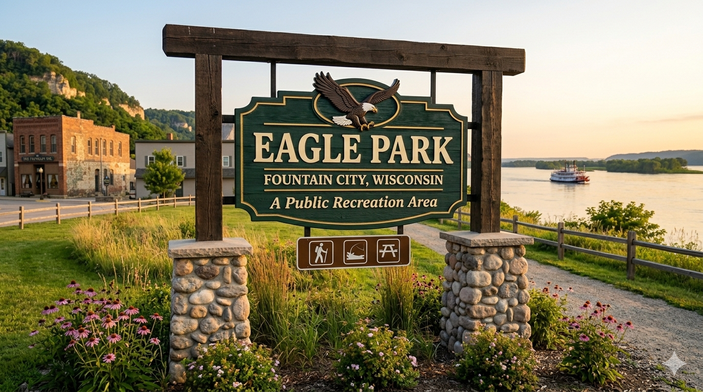
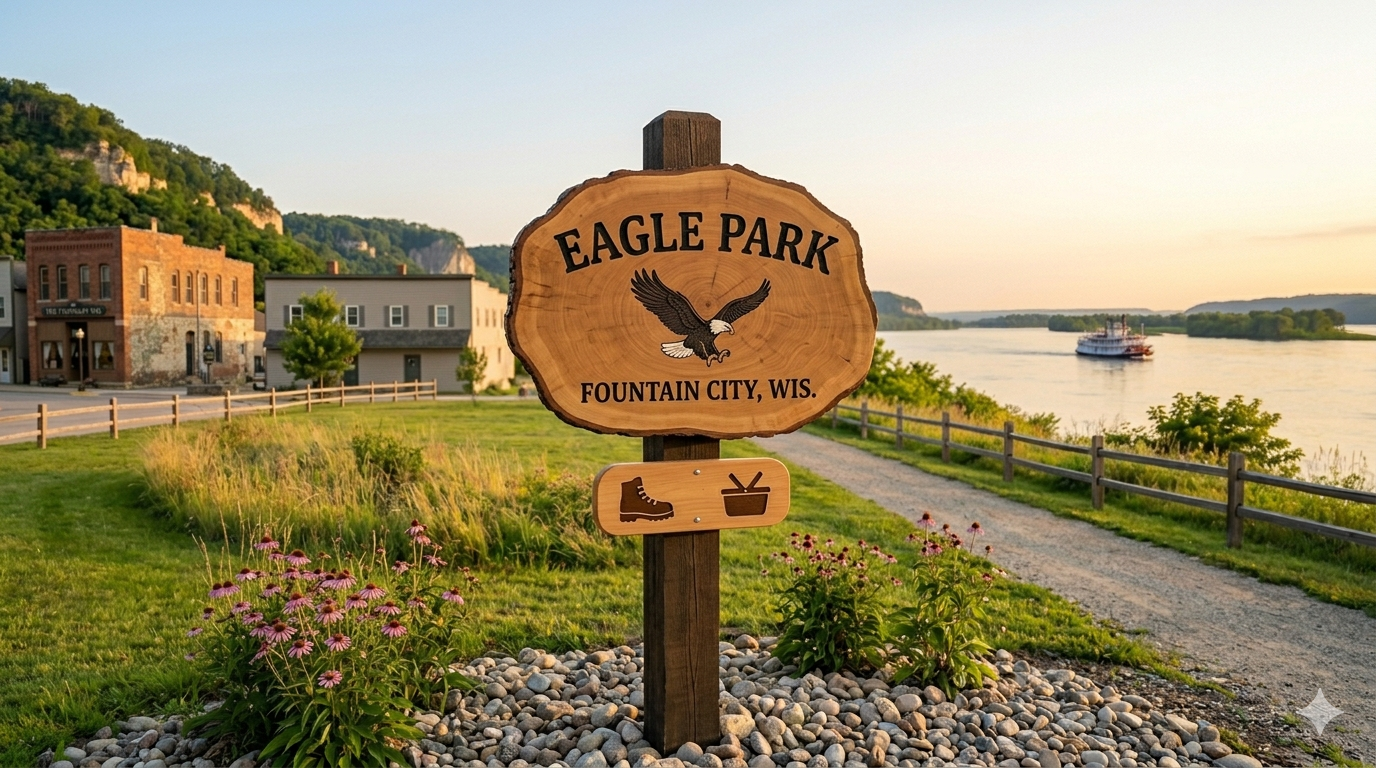
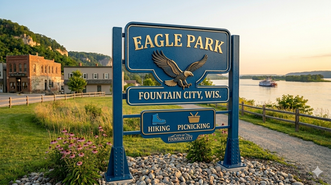
5.7 Park naming committee
City parks and city-owned spaces in Fountain City are often referred to by informal names used by residents and city staff. While these names carry local meaning, formalizing them through a transparent, community-driven process would give residents greater ownership over these spaces and create a natural opportunity for civic engagement. A park naming committee could be established to review existing informal names, solicit public input, and recommend official names along with themed signage for each space. This process could mirror the success of the historical society’s logo competition—turning what would otherwise be a routine administrative task into a community event that builds pride and attachment to local places.
6 Project suggestions: Intermediate strategies
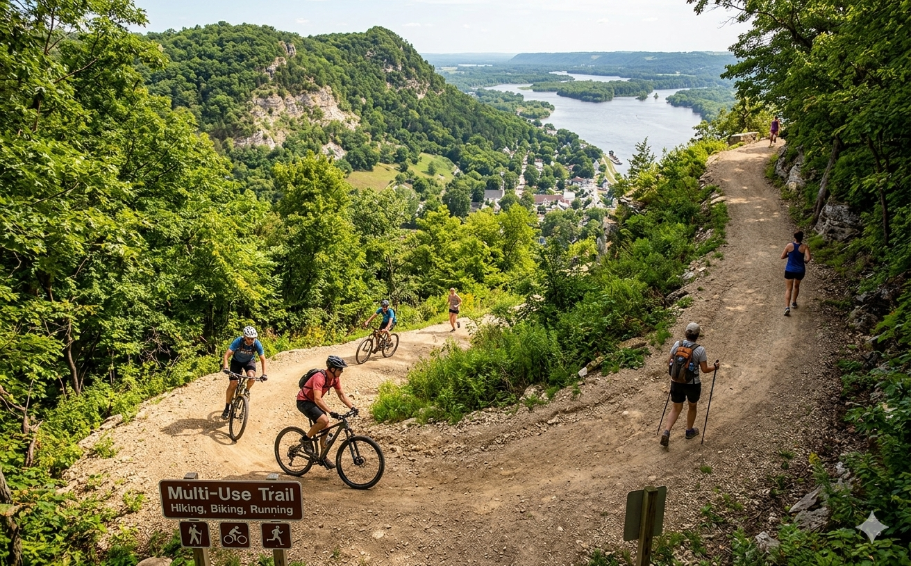
6.1 Multi-use trail implementation: Local access
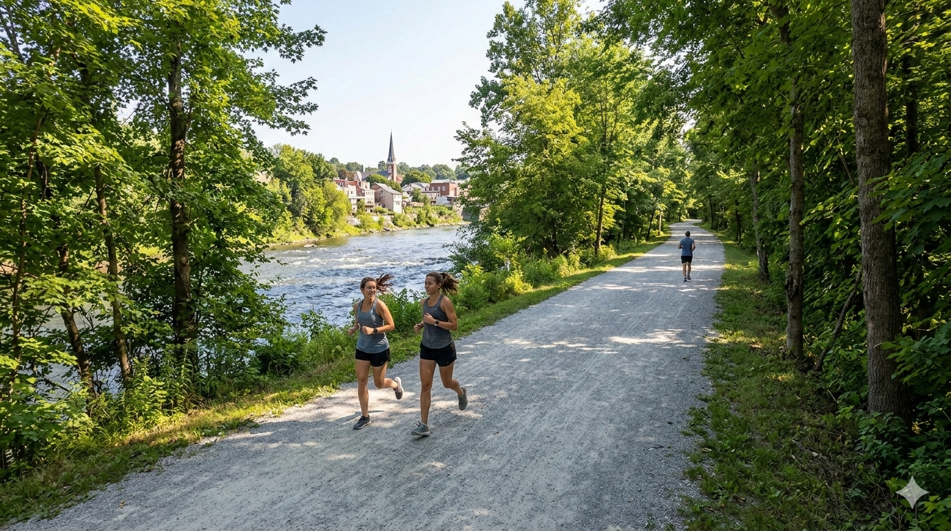
A multi-use trail is central to Fountain City’s long-term vision, connecting town amenities – from boat landings to parks to local businesses – and giving residents an in-town recreation option that doesn’t require a car. A phased approach allows the city to build on early successes before committing to larger investments. Three surface types are worth considering: concrete is the most durable and aesthetically polished but carries the highest upfront cost and is the most difficult to repair; asphalt offers a middle ground in cost and durability; and crushed gravel is the most affordable to install and maintain, though it limits some activities like rollerblading and is less accessible for people with mobility devices. The right choice will depend on the specific segment, available funding, and long-term maintenance capacity. Long-term, the trail system should pursue connectivity to surrounding Wisconsin river towns, Merrick State Park, and Winona, Minnesota.
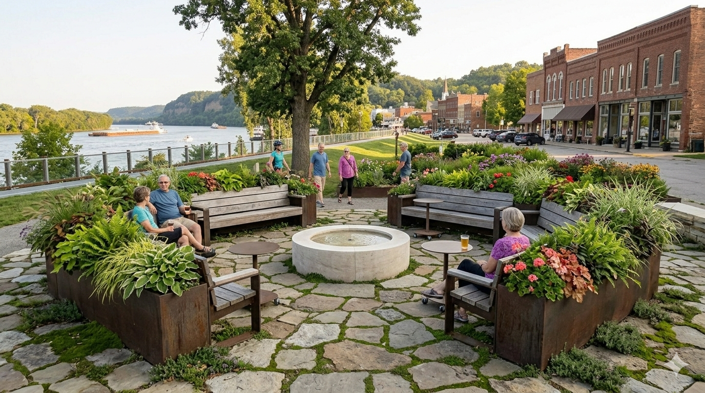
6.2 “Sticky” spaces for passive recreation
Sticky spaces are locations that attract people to stay not just for a short stop but a longer period of time. Creating these kinds of spaces is one of the most effective ways to increase foot traffic in a downtown and support local businesses. Potential spaces for passive recreation include:
- Planters and green space including seating, ideal for the city-owned space adjacent to the auditorium or along the river
- Hammock gardens, which could be placed at serene locations along the river or within existing park spaces where natural shade is present
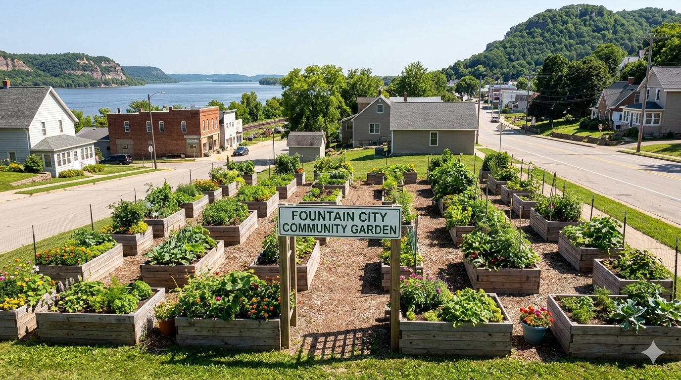
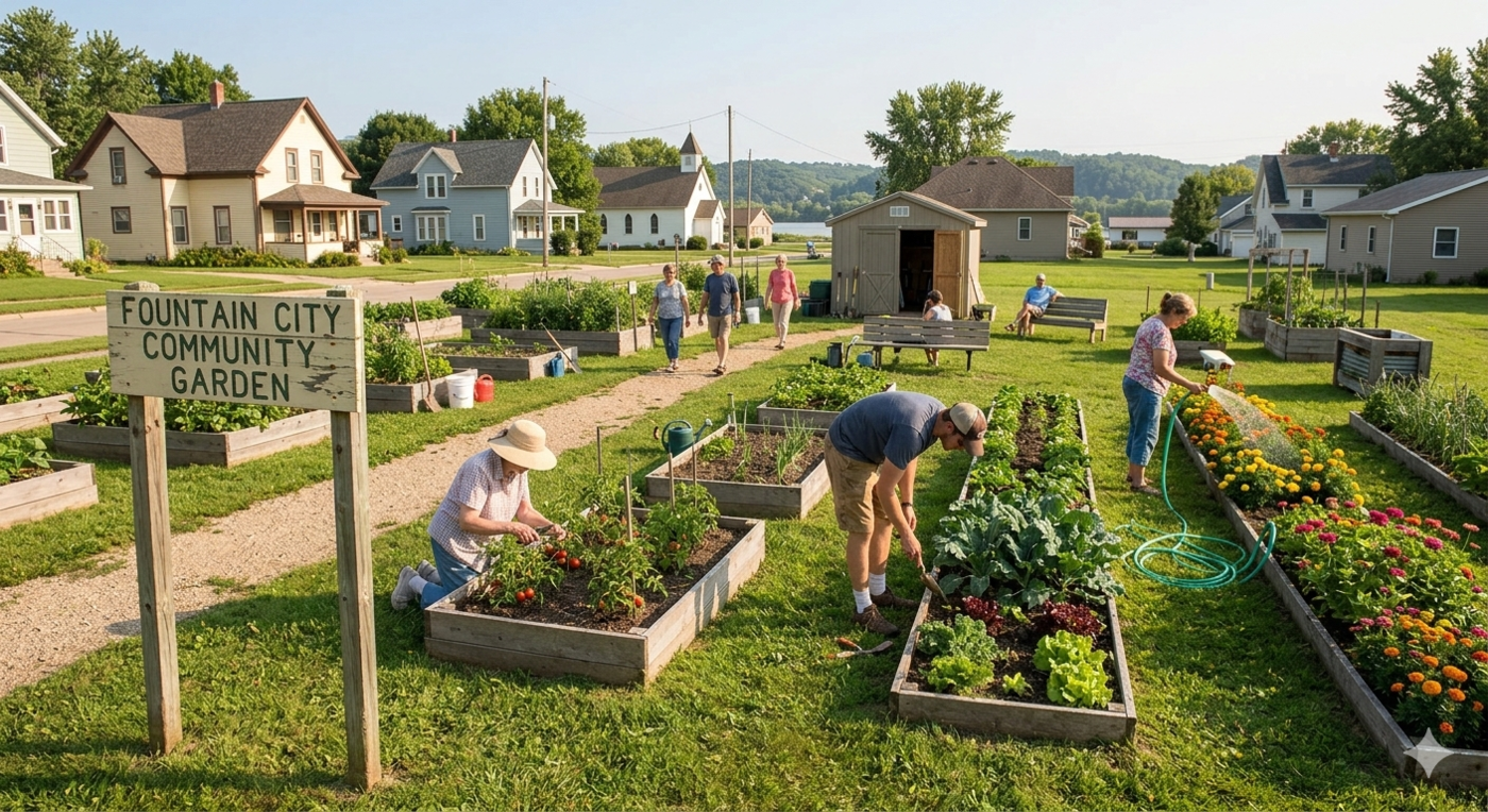
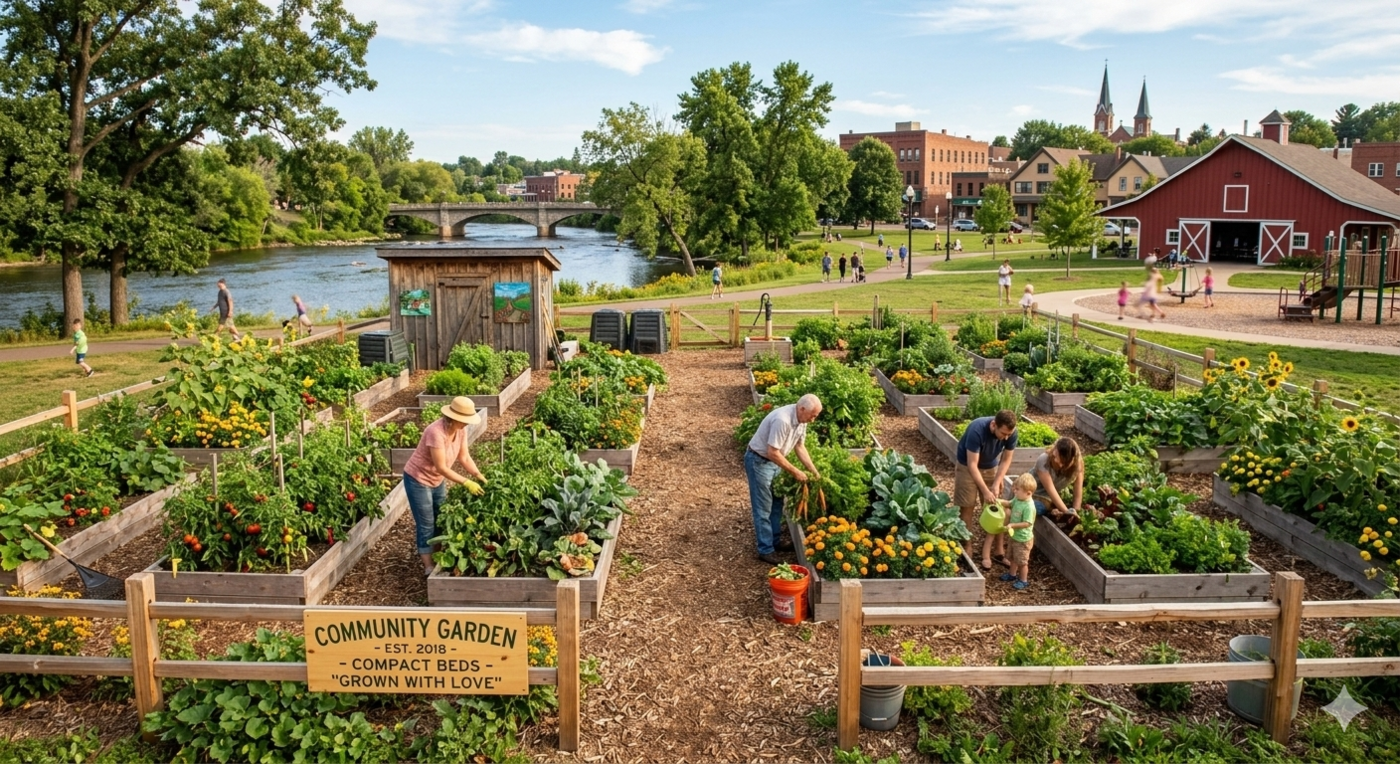
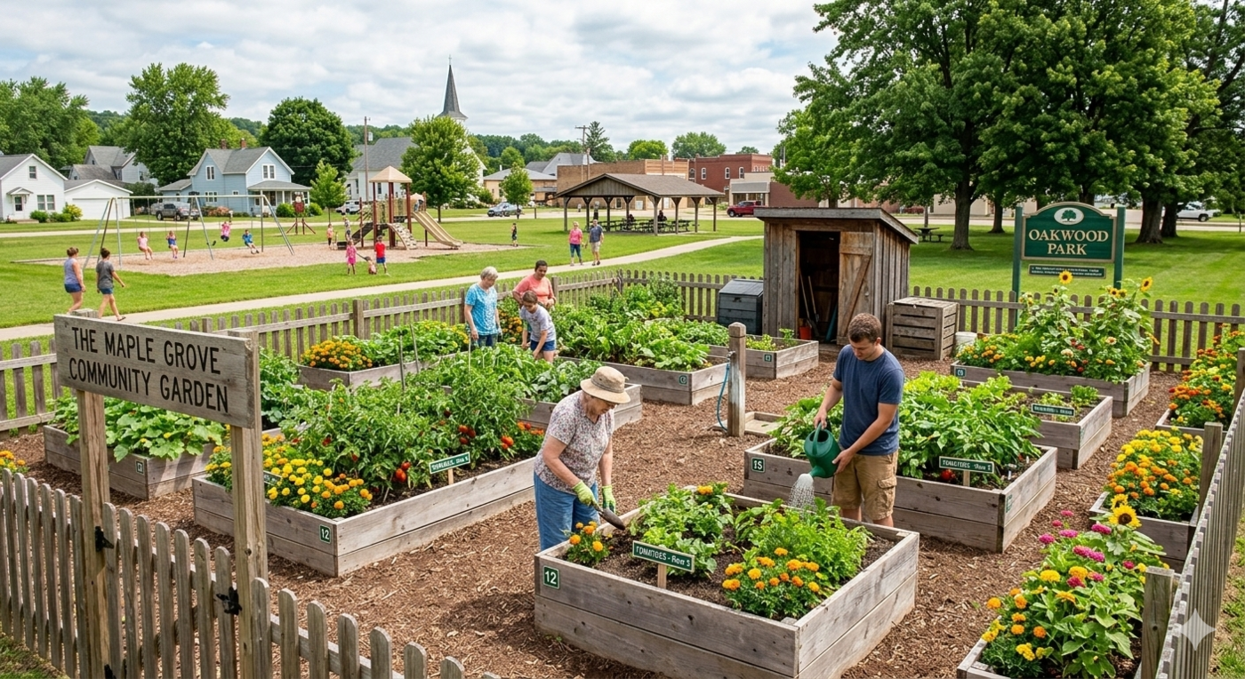
- Community gardens, which could be added onto incrementally as they are utilized more, on the park space currently owned by the railroad
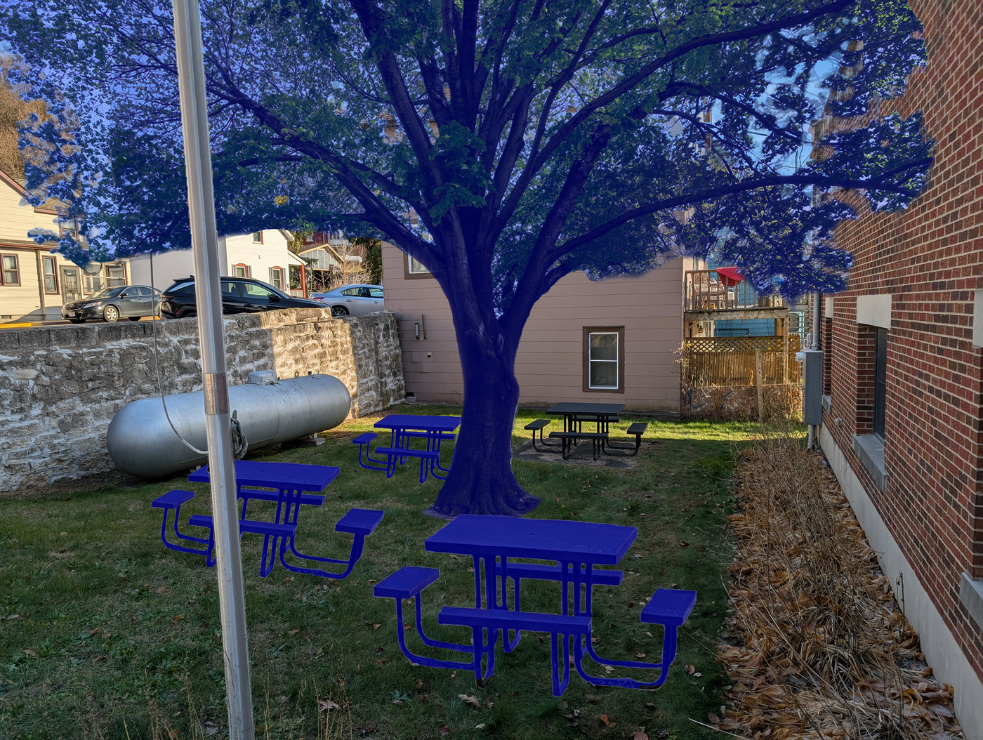
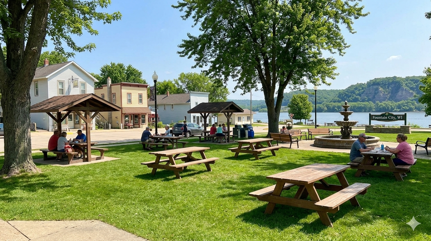
- Picnic benches, which could be used for informal events, gatherings, and meals, and are ideal for the city-owned space adjacent to the auditorium
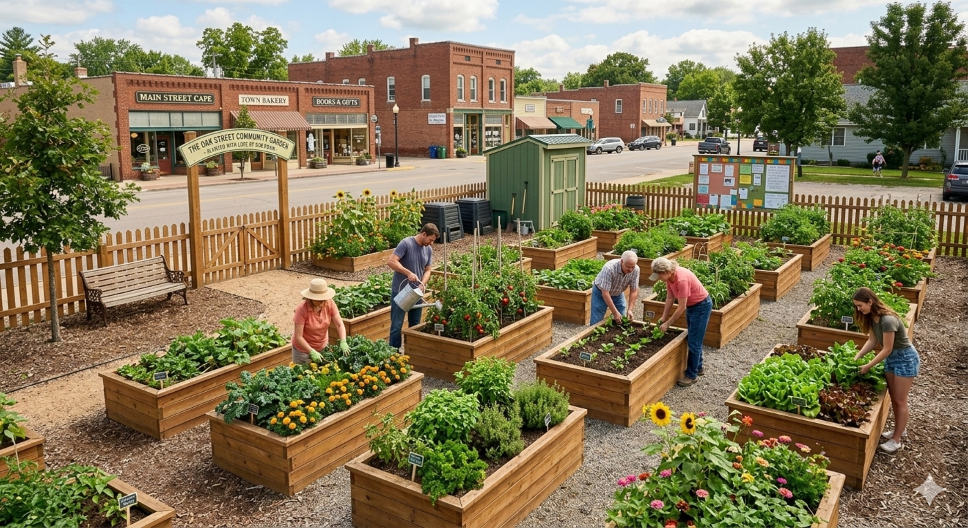
6.2.1 Community gardens
Community gardens offer a low-cost, high-impact way to activate underutilized land while building social connections among residents. They can be established incrementally—starting small and expanding as participation grows—keeping startup costs low and requiring minimal upfront investment. The railroad-owned property near the downtown core has been identified as a potential location, as it currently sits underutilized and is accessible from the surrounding neighborhood. Additionally, community gardens could be placed within Fountain City Community Park. A community garden at these locations would bring people together, improve the visual character of the corridor, and provide residents with a locally grown source of fresh produce.
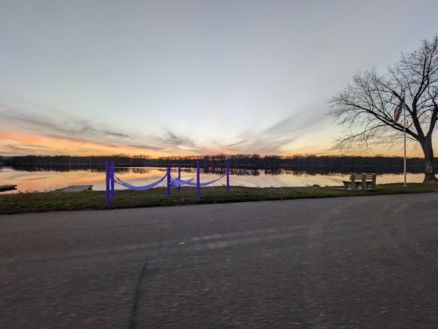
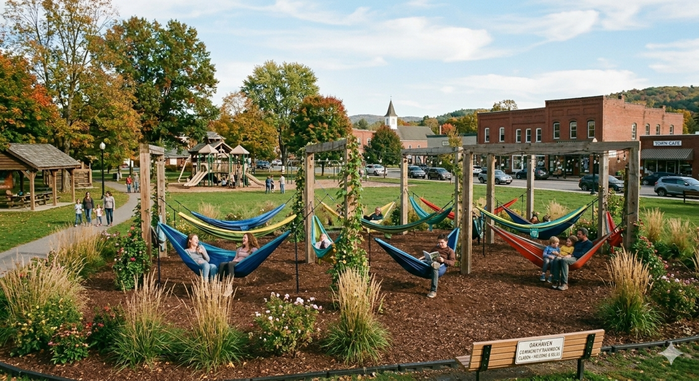
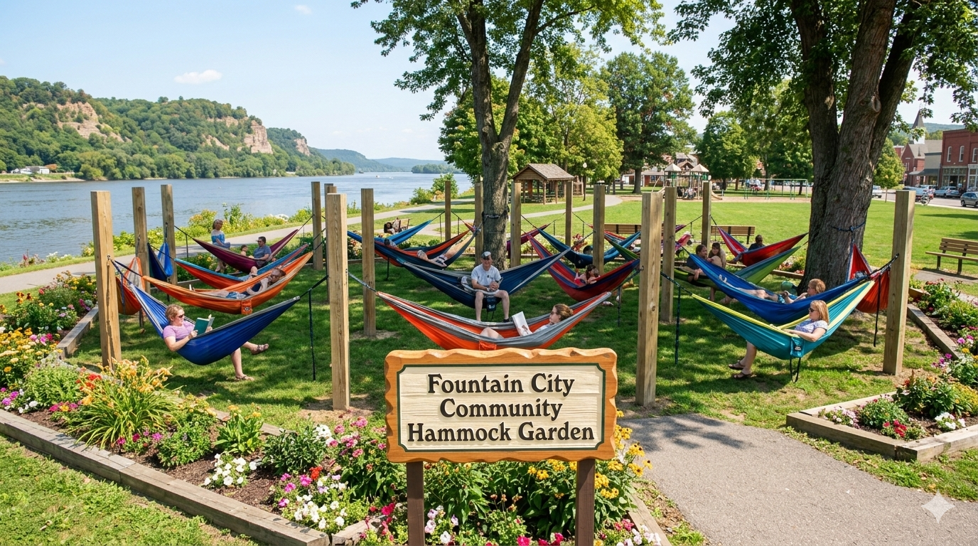
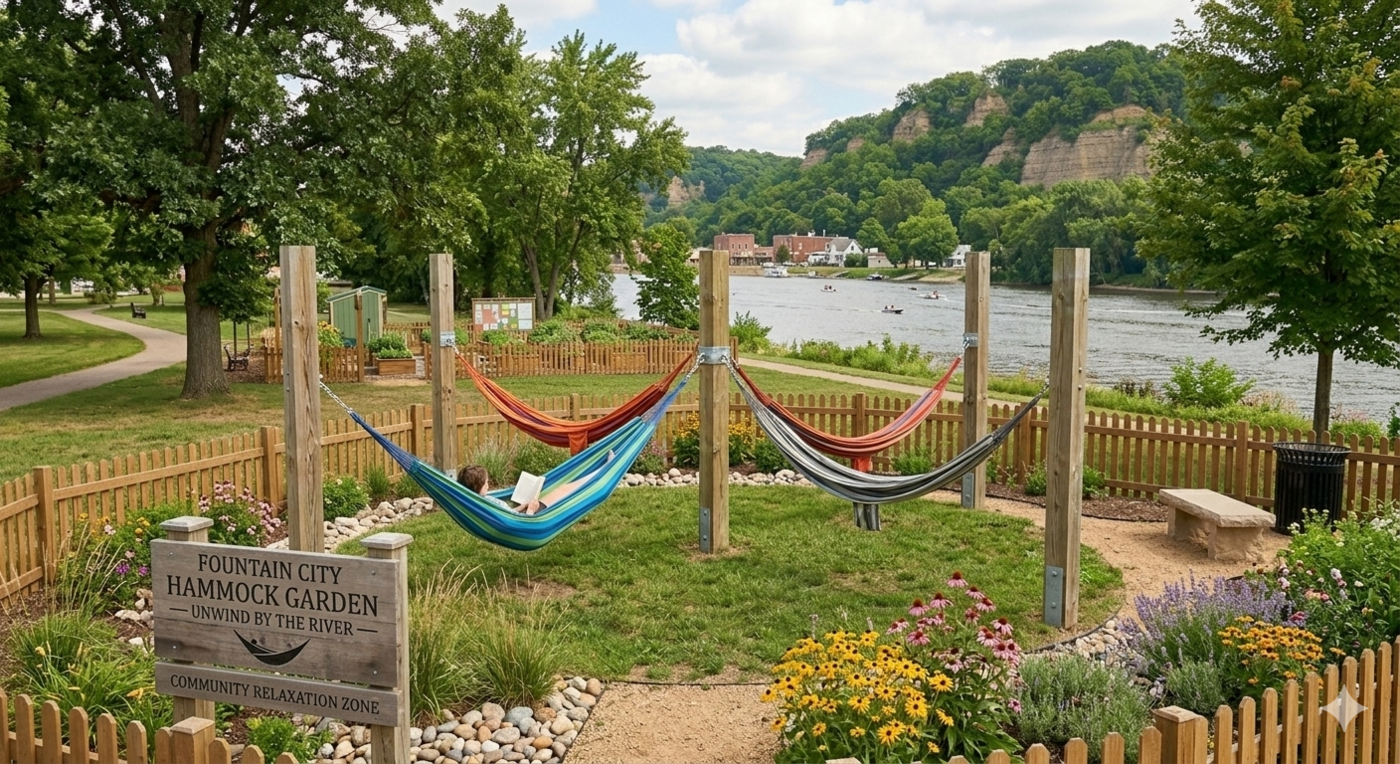
6.2.2 Hammock garden
A hammock garden offers a simple, low-cost way to create a destination space along the riverfront. By providing a place to relax and take in views of the Mississippi, a hammock garden would attract both residents and visitors looking for a quiet moment outdoors. This type of installation has been used successfully in other river towns and is relatively easy to maintain. Serene locations along the river or within existing park spaces would be ideal, particularly where natural shade is already present or where trees could be planted as part of a broader greening effort.


6.2.3 Picnic benches and outdoor seating
Outdoor seating is one of the most effective and affordable ways to activate a public space. The city-owned space adjacent to the auditorium is particularly well-suited for picnic benches and informal seating areas, as it sits near the downtown core and could serve as a gathering spot for events, meals, and casual social interaction. Strategically placed seating along the proposed trail system would also encourage people to slow down and linger, extending the time visitors spend in the community and supporting local businesses.


6.3 “Sticky” spaces for active recreation
In addition to passive recreation, Fountain City would benefit from amenities that draw residents and visitors through active use. Several types of active recreation infrastructure were identified through the community feedback process as priorities. Many of these can be implemented incrementally as funding becomes available, and placing them near existing parks and along the proposed trail system would maximize visibility and encourage people to spend more time in public spaces.
Potential spaces for active recreation include:
- Skate park
- Splash pad
- Bouldering wall
- Workout equipment, which could be placed near playgrounds to give adults activity options while kids play
- Public beach access
- Kayak rack near the beach access point to encourage river recreation
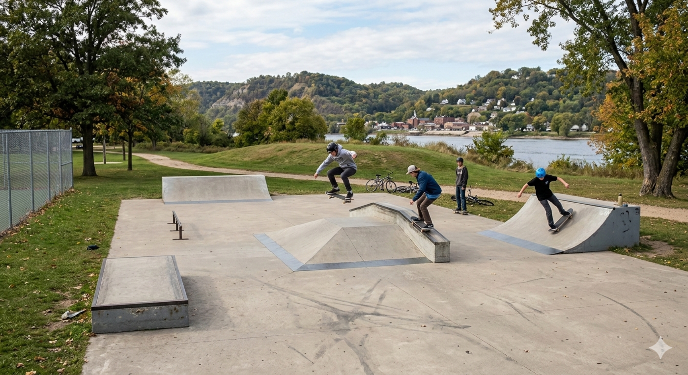
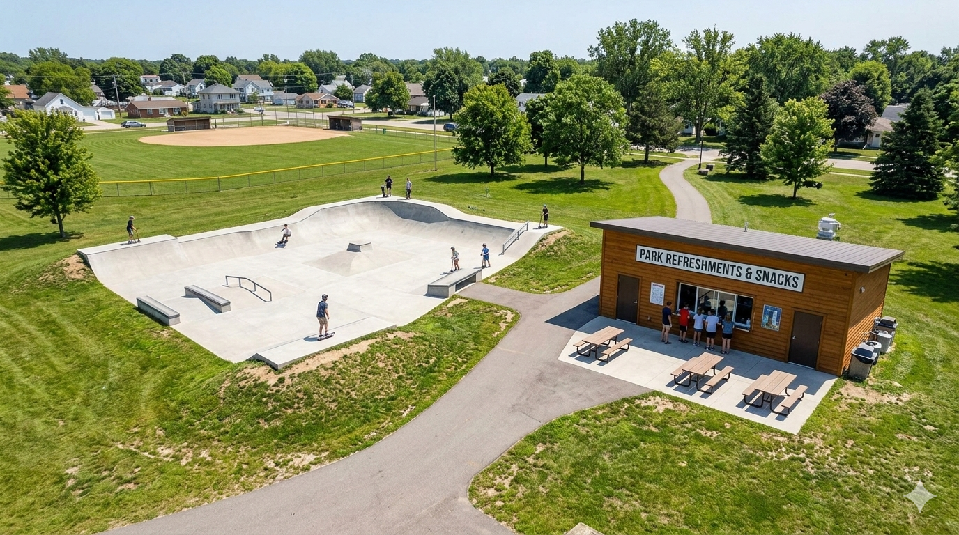
6.3.1 Skate park
A skate park would give Fountain City’s youth a dedicated space for skating, skateboarding, and BMX riding—amenities that are currently absent from the community. Beyond serving youth, modern skate parks are used by people of all ages and have been shown to activate public spaces in small towns. The city should evaluate available sites near existing park infrastructure and consider involving youth in the design process to ensure the facility meets their needs and builds a sense of ownership.
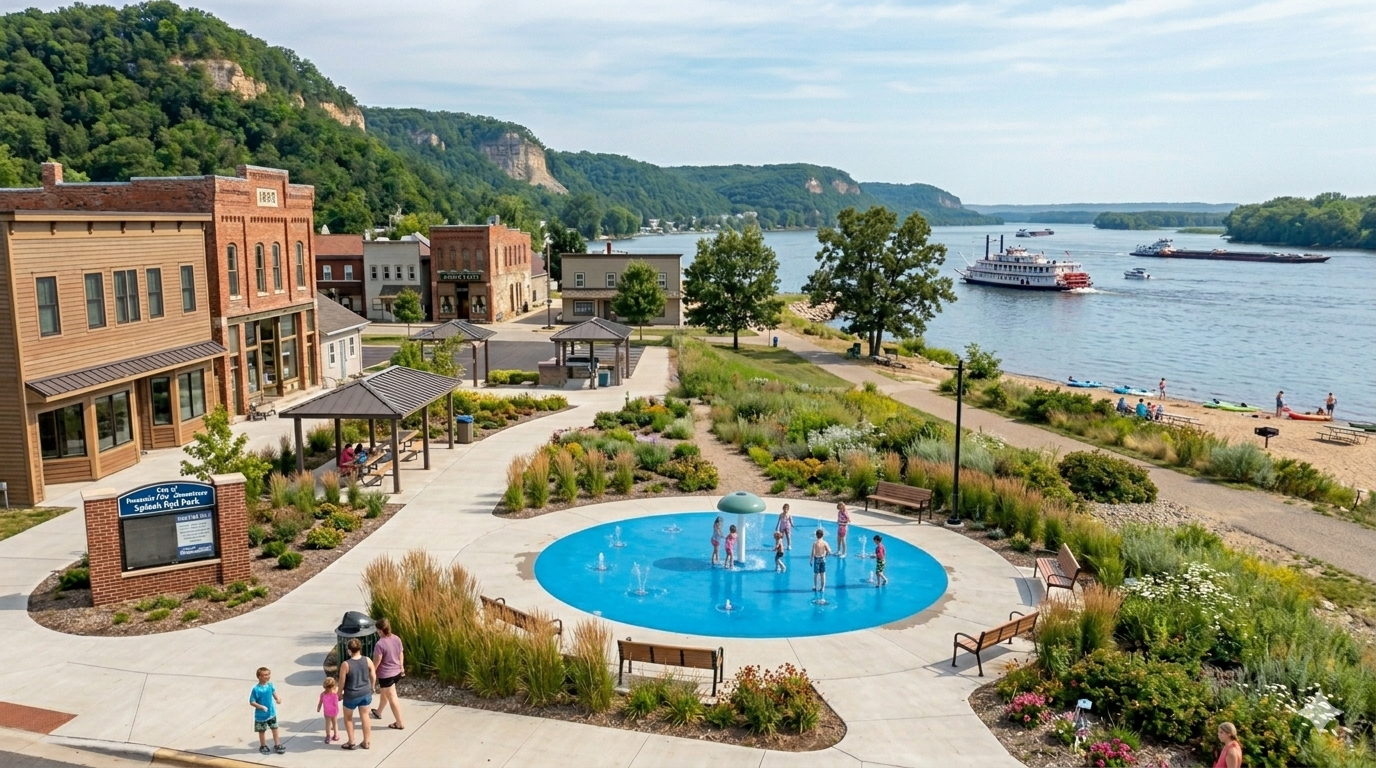
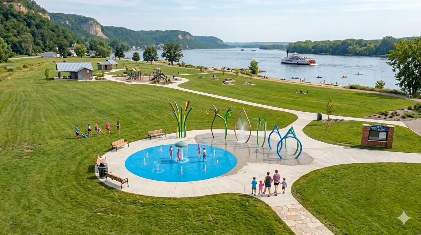
6.3.2 Splash pad
A splash pad is a family-friendly amenity that can significantly increase foot traffic in a public park during the summer months. Unlike a traditional pool, splash pads are relatively low-maintenance, do not require lifeguards, and are accessible to a wide range of ages. For a small city like Fountain City, a well-designed splash pad near the existing park and bandshell could become a regional draw, attracting families from surrounding communities and reinforcing the city’s appeal as a recreational destination on the Great River Road.
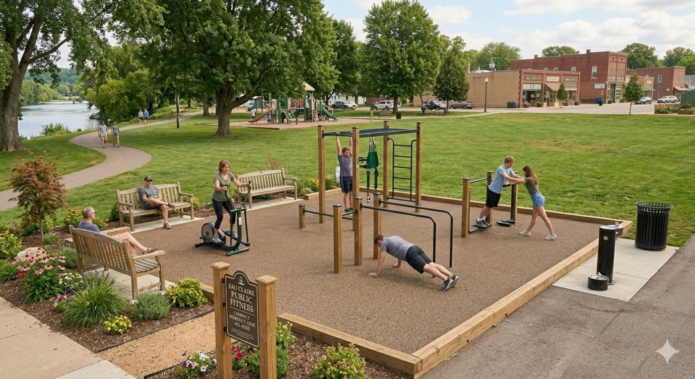
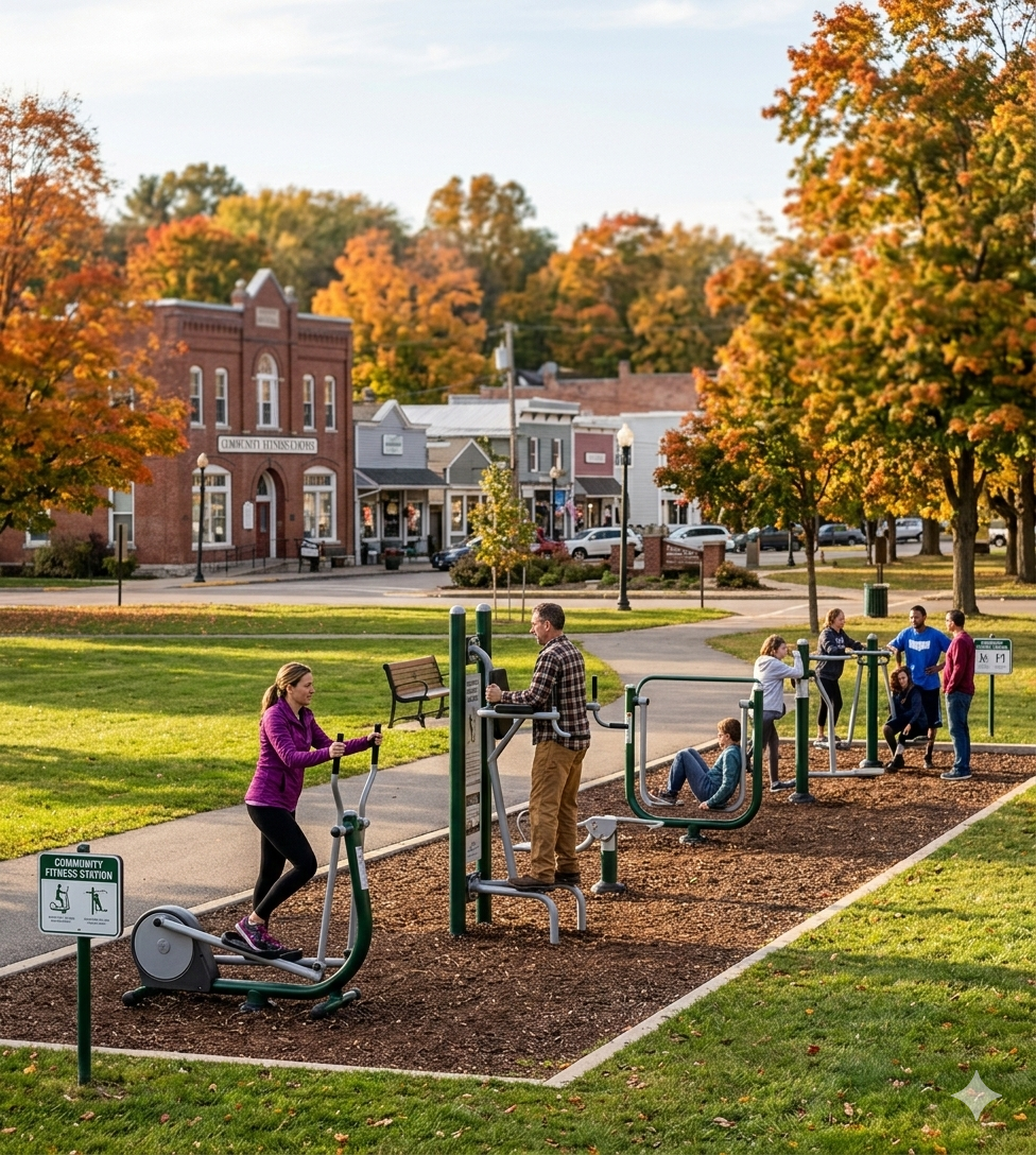
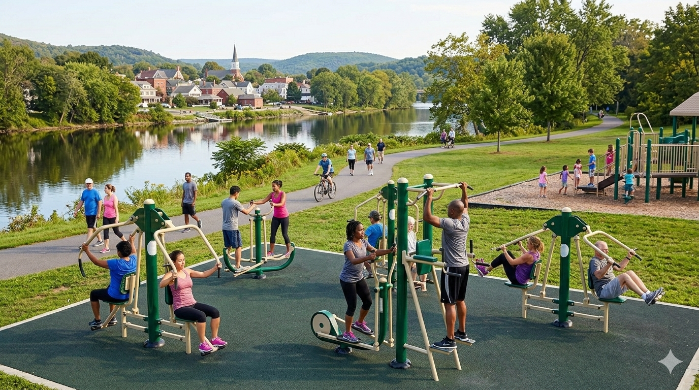
6.3.3 Outdoor workout equipment
Outdoor workout equipment placed near existing playgrounds would give adults an active option while children play, making parks more useful and appealing to families. This type of amenity requires minimal maintenance, has a relatively low installation cost, and signals a community investment in the health and wellbeing of residents. Equipment should be selected for durability and year-round usability, and positioned with good sightlines to adjacent playground areas.
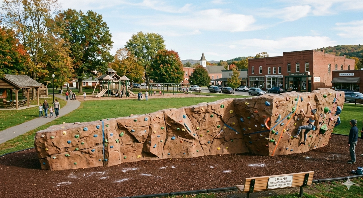
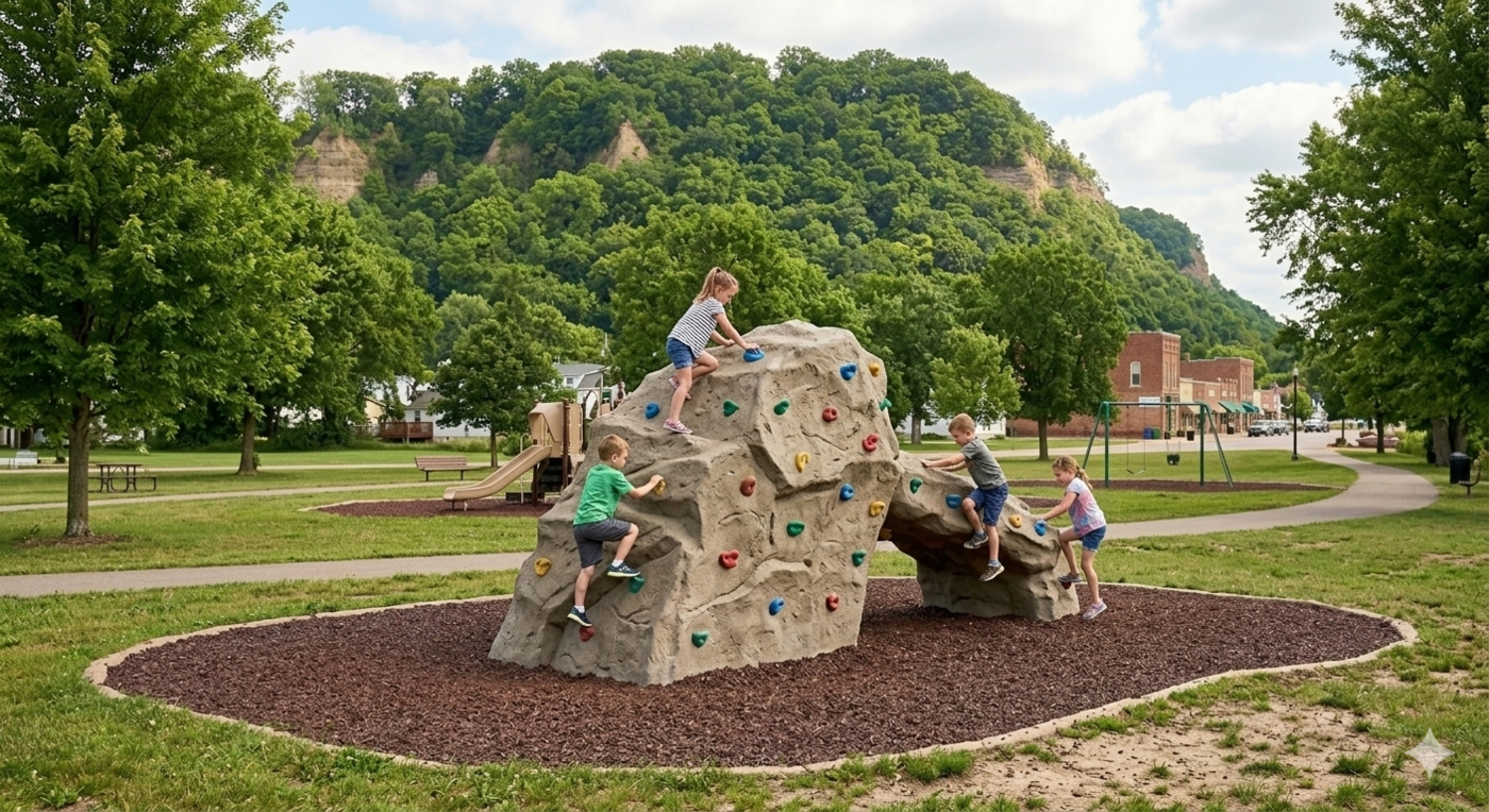
6.3.4 Bouldering wall
A bouldering wall is a low-barrier, high-appeal amenity that serves a wide age range and requires no specialized equipment or instruction to enjoy. Unlike a full climbing wall, a bouldering wall sits close to the ground and is relatively affordable to construct and maintain. Placed near existing park infrastructure, it would add a distinctive active recreation option that few small communities offer and help draw visitors who are looking for something beyond a standard park experience.
The color and texture of the wall could be chosen to echo the limestone bluffs that define Fountain City’s landscape—reinforcing the local identity of the installation and creating a visual connection between the built environment and the natural features that make the city distinctive.
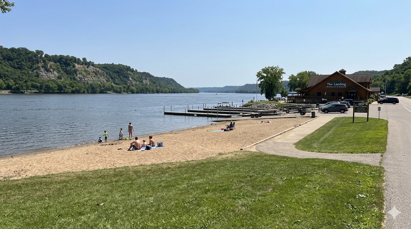
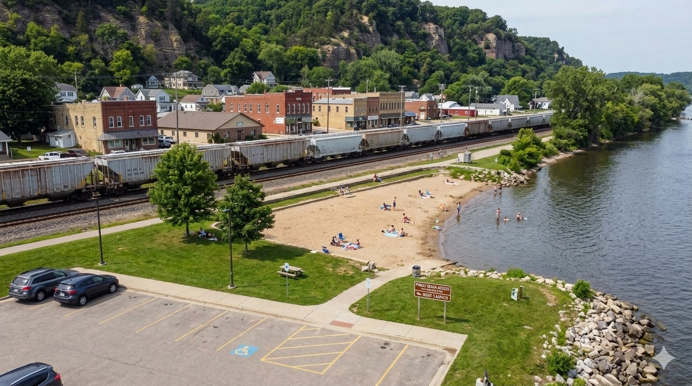
6.3.5 Public beach access
Public beach access along the Mississippi River would be a significant asset for Fountain City, providing a free, family-friendly destination that takes full advantage of the city’s waterfront location. Identifying a suitable site with safe water access, adequate parking, and a connection to the proposed trail system should be a near-term priority. A kayak rack near the beach access point would further encourage river recreation and give visitors an additional reason to stop and stay.
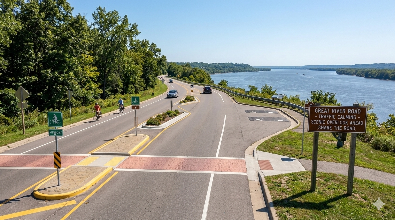
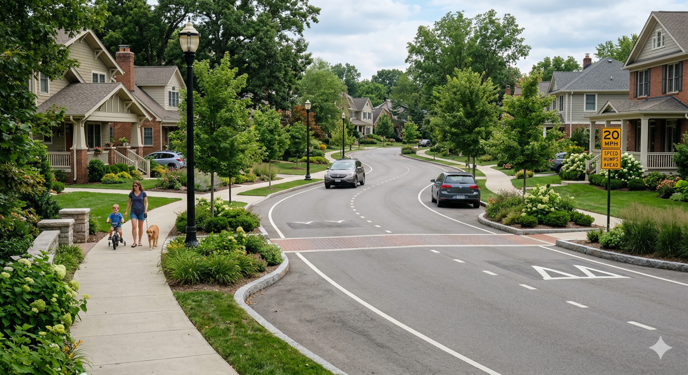
6.4 Traffic calming mechanisms
Traffic calming is a consistent priority across community feedback. The Great River Road passes directly through Fountain City’s downtown, and high vehicle speeds along this corridor undermine the pedestrian environment and make it difficult for residents and visitors to feel comfortable walking, biking, or lingering in public space. A range of traffic calming approaches are discussed in this report—from near-term solutions like improved crosswalks and signage to longer-term infrastructure investments like roundabouts and chicanes. Taken together, these measures can meaningfully improve the character of the downtown and make it safer and more inviting for people on foot. More intensive infrastructure investments—roundabouts, boulevards, and chicanes—are addressed in the long-term goals section of this report.
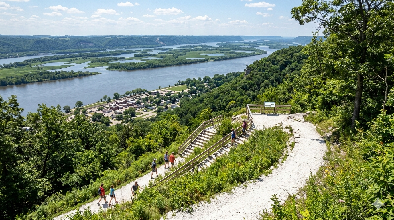
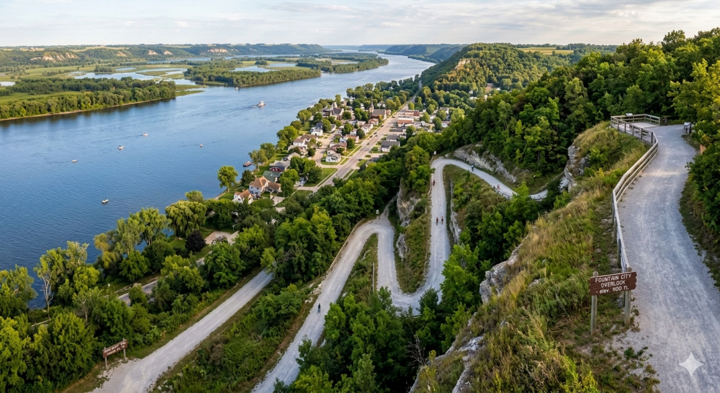
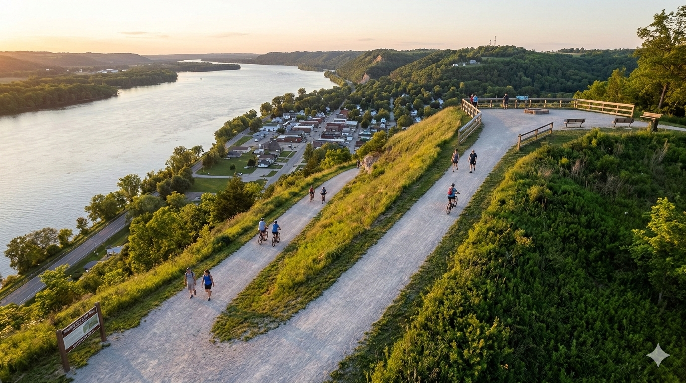
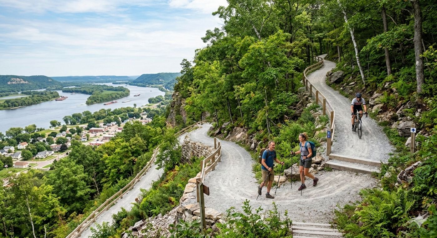
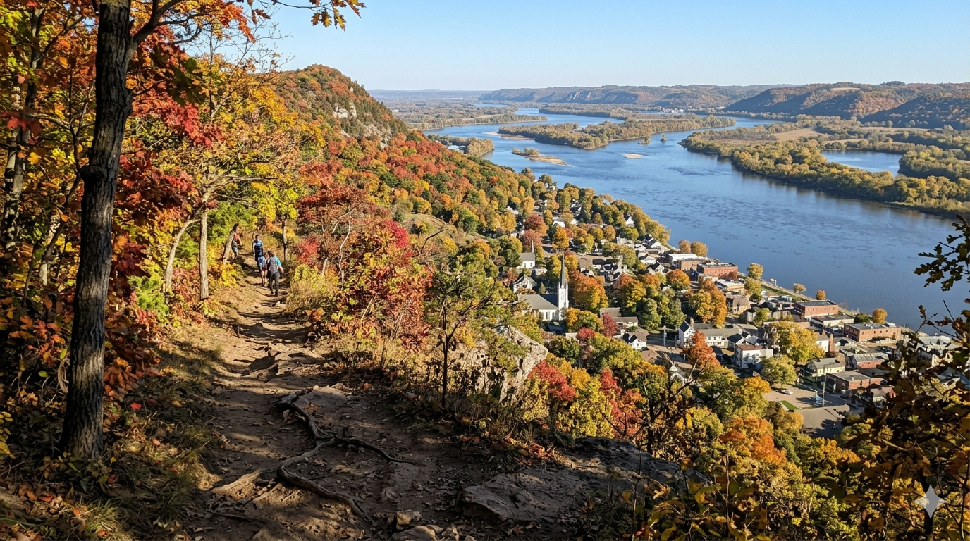
6.5 Bluff trail(s)
Through the committee’s web survey and focus groups, the bluffs were identified as a major asset and identifying marker of the town. In the past, residents were able to hike to the top of the bluff from behind the old fire station. Currently, residents and visitors can hike to the top from behind Castle Rock Sourdough, but this location is well outside of city limits—south of town and disconnected from Fountain City’s downtown core.
Ideally, a new bluff trail would be accessible from downtown and connected to the Downtown Spur of the Fountain City trail. New trail development would require coordination with current property owners, and multiple surface options could be evaluated depending on terrain and budget. A downtown-connected bluff trail would be a distinctive amenity—something few towns in the region can offer—and would strengthen Fountain City’s appeal to both residents and visitors seeking an active outdoor experience.
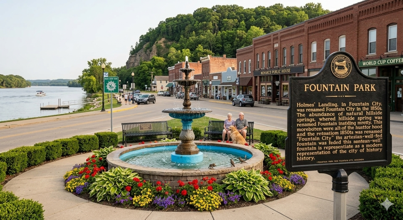
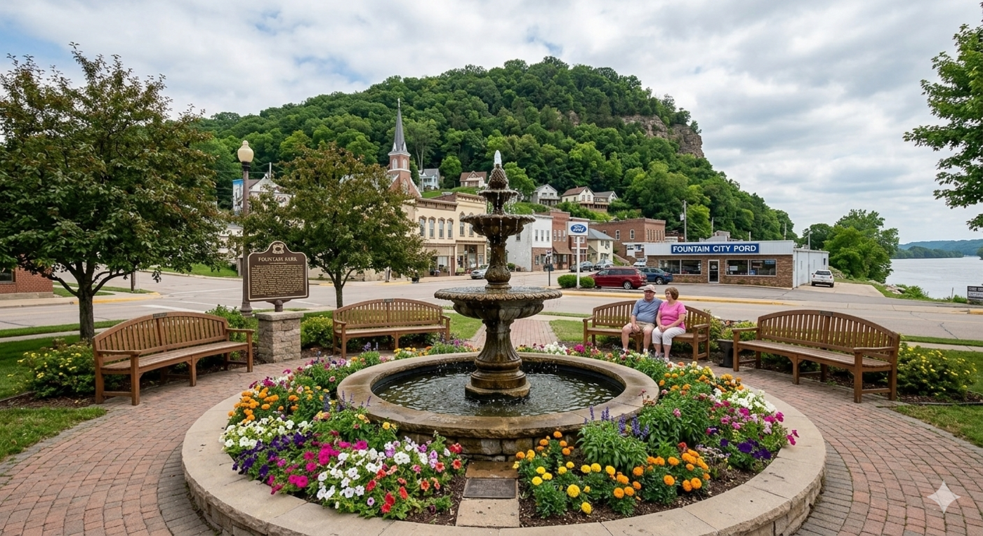
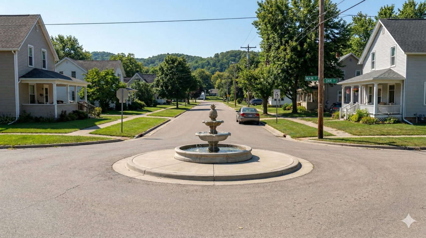
6.6 Making Fountain City the municipality with the most fountains in Wisconsin
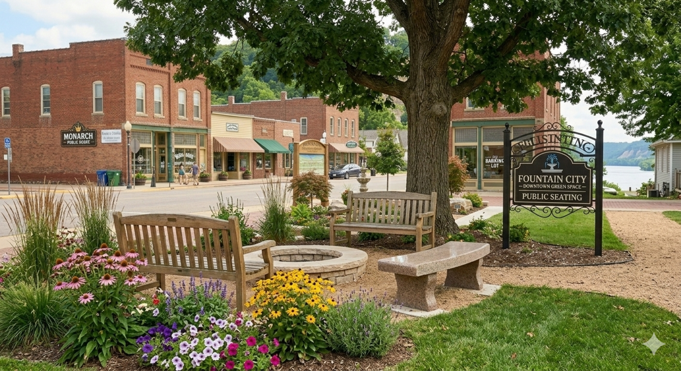
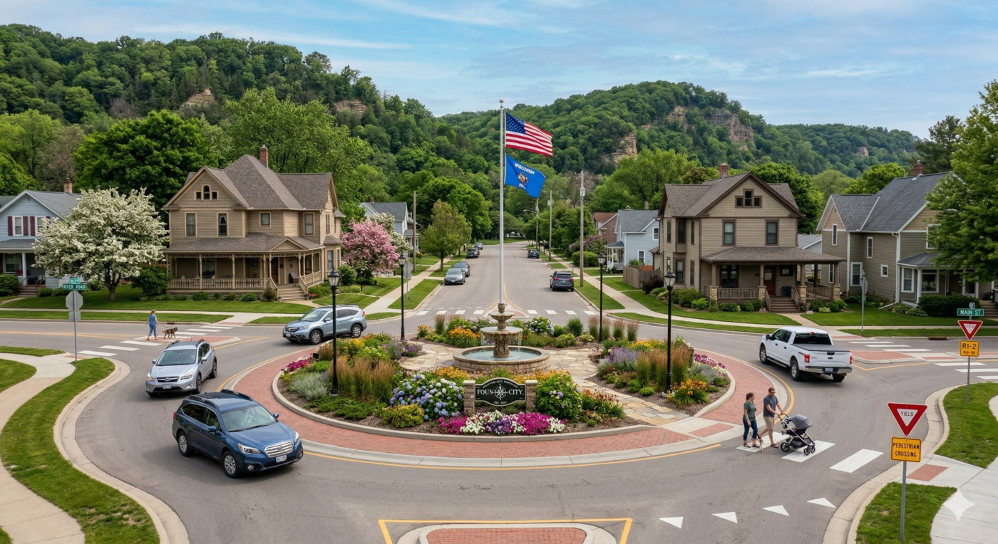
Fountain City’s name is one of its most underutilized assets. Milwaukee currently holds the distinction of having the most fountains in Wisconsin, with seven. Adding just a few well-placed fountains could allow Fountain City to surpass that number and claim the title outright—a distinction that could meaningfully boost the city’s notoriety and appeal to visitors. The city recently had a large brass fountain donated, which could anchor a prominent public location as a centerpiece installation. Ideally, new fountains would incorporate passive or energy-efficient power sources such as gravity-fed systems or low-draw pumps to minimize operating costs. Good locations include downtown intersections, traffic circles, riverfront gathering areas, and the area near the bandshell.
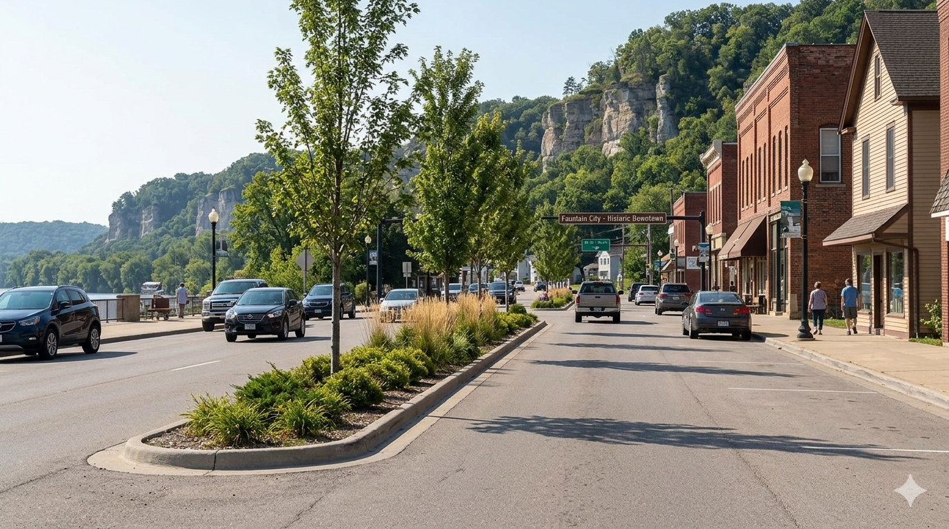
6.7 Tree planting
Street trees are a cost-effective investment that cities can make in their public realm. Trees reduce traffic noise, slow vehicle speeds by visually narrowing roadways, provide shade, manage stormwater, and improve the overall aesthetic quality of streets and public spaces. Several locations in Fountain City have been identified as priorities for tree planting, including vacant land along Baertsch Court, along the Great River Road at the northern edge of city limits, and along North Street north of St. Mary’s Cemetery. The city should explore partnerships with the Wisconsin Department of Natural Resources and programs like Tree City USA to offset costs and support long-term maintenance.
While a single row of street trees does not significantly reduce traffic noise, it does create a visual narrowing effect that tends to slow vehicle speeds—an inexpensive form of passive traffic calming that complements the more structural interventions described elsewhere in this report.
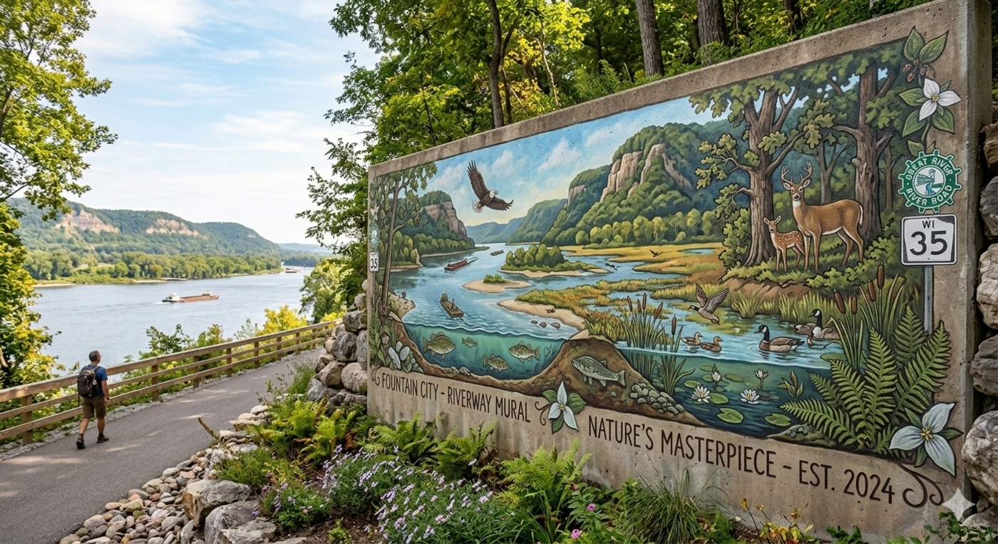
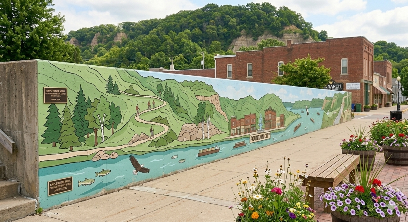
6.8 Murals
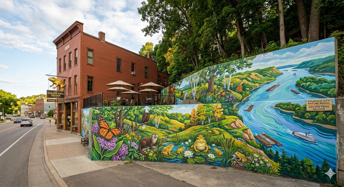
Urban murals are a powerful tool for beautifying public space, building a sense of place, and expressing local identity. A well-designed mural can transform an otherwise overlooked wall into a landmark—giving residents and visitors alike a reason to pause and engage with their surroundings. The committee recommends that the city pursue mural projects in partnership with a local or regional artist, prioritizing designs that reflect Fountain City’s history, natural landscape, and cultural character. Involving local students—from Cochrane-Fountain City High School or nearby Winona State University—could reduce costs while deepening the community connection to the finished work. Two locations make logical sense for public murals, pending property owner approval: the flatiron building on Main Street and the retaining wall near the Golden Frog.
6.9 Ballfield improvements
Fountain City’s ballfields are a regional asset with the potential to draw teams and spectators from surrounding communities, including Winona. Improvements to lighting, aesthetics, seating, shading, batting cages, and irrigation would make these fields more functional and appealing for players and spectators alike. Work on the ballfields is already underway, reflecting the strong community interest in this resource. Enhanced facilities could help the city attract additional tournaments and events, which generate economic activity for local businesses and increase overnight stays in the area. The city should engage with the school district and regional recreational leagues to identify the highest-priority remaining improvements and explore cost-sharing arrangements that distribute the investment across multiple stakeholders.
6.10 Public “showpieces”
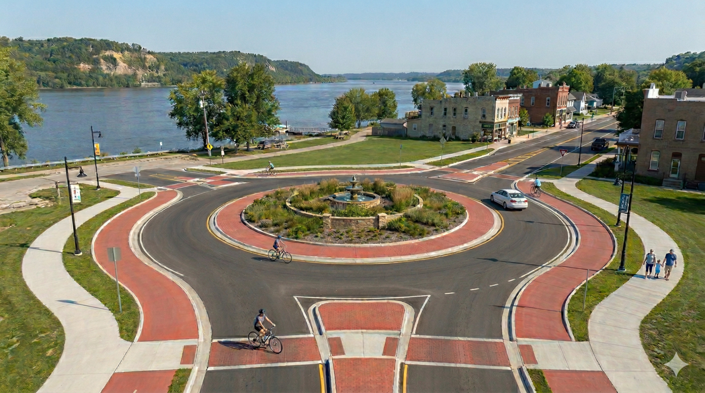
Public showpieces are places and installations that become synonymous with a community’s identity—the spots that appear on postcards, that residents direct visitors toward, and that people carry in their mental map of a place. Fountain City has several natural candidates: Fountain Park and the flatiron building on Main Street, the bandshell at the city park, and the upper docks area. Investing in these locations through landscaping, lighting, signage, and design improvements would reinforce their role as the city’s most iconic spaces. The upper docks area in particular presents an opportunity for a pedestrian trestle and boardwalk that would connect The Landing to the Golden Frog, creating a memorable riverfront promenade.


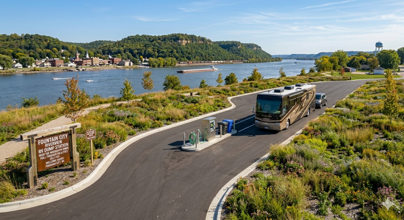
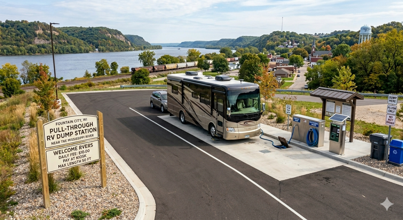
6.11 Pull-through RV Dump Station at water treatment site
A pull-through RV dump station at the city’s water treatment site would address a gap in services for the significant number of RV travelers who pass through Fountain City on the Great River Road each year. Providing this amenity—ideally at a modest fee—would encourage RV travelers to stop in the city, patronize local businesses, and potentially return for longer stays. The water treatment site is well-suited for this use given its existing infrastructure, and a pull-through configuration would accommodate large vehicles without creating congestion. This is a relatively low-cost improvement with a clear economic development rationale.
7 Project suggestions: Long-term goals
7.1 Multi-use trail implementation: Regional connections
The phased trail system described in the Intermediate Strategies section focuses first on intra-city connectivity, but Fountain City’s long-term trail vision extends well beyond city limits. The two most significant regional connections are northward to Merrick State Park and southward to the Flyway Trail near the Winona Bridge—a route that would ultimately link Fountain City to Winona, Minnesota and to an existing network of recreational trails along the Mississippi River corridor.
Achieving these connections will require multi-year coordination with WisDOT, Buffalo County, the National Park Service, and the railroads that control key right-of-way segments. The city should treat regional trail connectivity as a standing policy goal—raising it consistently in conversations with county and state officials, pursuing easements proactively, and applying for grant funding through programs like the Transportation Alternatives Program. Even modest early investments—crosswalks, short trail segments, connections to adjacent bike routes—can signal momentum and materially strengthen future grant applications.
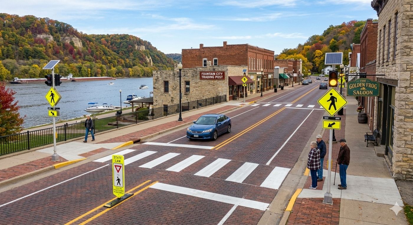
7.2 Traffic calming mechanisms: crosswalks
Marked crosswalks with high-visibility signage and pavement treatments are one of the most straightforward and affordable ways to improve pedestrian safety in Fountain City. Several locations along the proposed trail system and the downtown core warrant crosswalk improvements, particularly where trail routes intersect with the Great River Road. Raised crosswalks—which function as a speed table as well as a pedestrian crossing—are especially effective at slowing traffic and increasing driver awareness. The city should prioritize crosswalk improvements at intersections with high pedestrian activity and where trail phases cross major roadways.
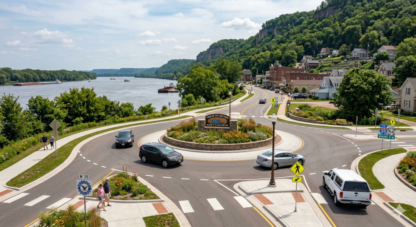
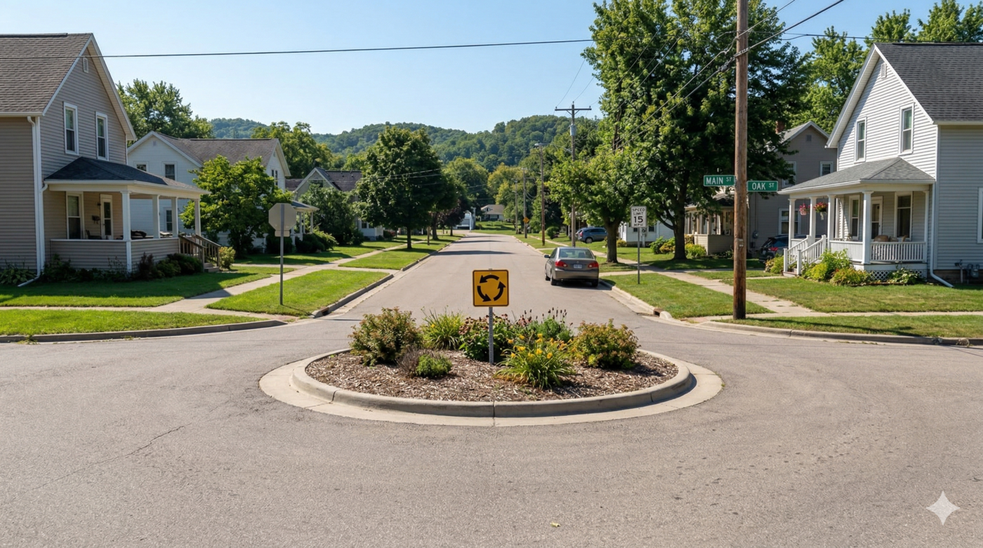
7.3 Traffic calming mechanisms: roundabouts
Roundabouts are a proven traffic calming tool that reduce vehicle speeds, improve safety, and can enhance the visual character of key intersections. Unlike stop signs or traffic signals, roundabouts keep traffic moving at a controlled pace and significantly reduce the severity of collisions by eliminating high-speed right-angle conflicts. For Fountain City, roundabouts at key intersections along the Great River Road could serve as gateway features—slowing traffic as it enters downtown and signaling to drivers that they are entering a pedestrian-oriented environment. The city should identify the highest-priority intersections and begin conversations with WisDOT about feasibility and funding pathways.
A Dutch-style roundabout—also known as a protected intersection—would represent a more significant investment in traffic safety and bicycle infrastructure, but one worth considering at a key intersection in Fountain City. Unlike a standard roundabout, the Dutch design physically separates cyclists and pedestrians from vehicle traffic through dedicated paths, dramatically reducing conflict points and making the intersection safer for all users. This design is well-established in the Netherlands and increasingly common across Europe, though it remains unimplemented in the United States—making it a genuinely distinctive feature if implemented here. The city should identify the intersection most in need of intervention and begin a dialogue with WisDOT about whether a protected intersection design could be incorporated into a future road improvement project.
7.4 Traffic calming mechanisms: boulevards
A boulevard treatment divides a roadway with a planted median, reducing the perceived width of the street and encouraging slower driving. Boulevards also provide significant aesthetic benefits, creating a more tree-lined, park-like streetscape that enhances the quality of the pedestrian environment. For Fountain City, a boulevard treatment on key segments of the downtown could reinforce the sense of arrival, provide opportunities for tree canopy expansion, and signal a clear transition from highway to main street.
Maiden Rock, Wisconsin has already implemented a boulevard treatment along the Great River Road and offers a useful nearby model for what this type of intervention looks like in a similar small river town context.
7.5 Traffic calming mechanisms: chicanes
Chicanes are a series of alternating curves introduced into a roadway to slow vehicle speeds without stopping traffic flow. They are particularly effective on long, straight roadway segments where drivers naturally accelerate. In Fountain City, chicanes could be implemented along stretches of the Great River Road that pass through the downtown, using alternating bump-outs or on-street parking bays on opposite sides of the road to create a slalom-like effect that naturally reduces vehicle speeds.
7.6 Traffic calming mechanisms: traffic circles
Traffic circles—smaller than full roundabouts and typically placed at residential intersections—are a low-cost tool for slowing neighborhood traffic and creating opportunities for landscaping and public art. A traffic circle with a fountain or planting at its center could serve double duty: calming traffic while adding a distinctive visual element to the streetscape. Given Fountain City’s interest in adding fountains throughout the city, traffic circles could provide natural locations for smaller-scale fountain installations at key intersections.
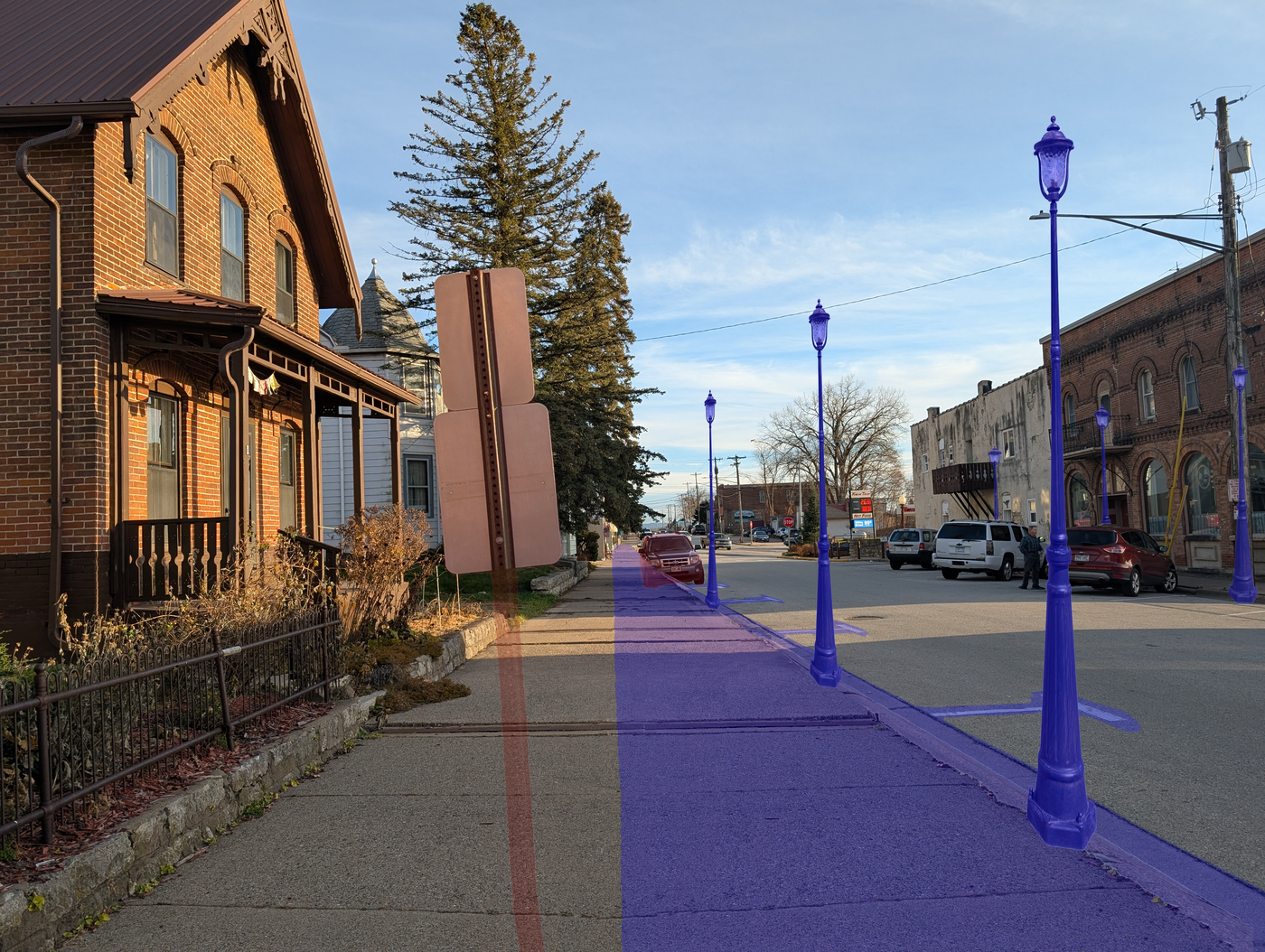
7.7 Sidewalk expansion and historic lighting fixtures
A dedicated downtown district with expanded sidewalks and period-appropriate lighting fixtures would significantly improve the pedestrian experience in Fountain City’s core. Wider sidewalks give people more room to walk comfortably alongside moving traffic and create space for outdoor seating, planters, and other activating elements. Historic lighting fixtures—similar to those found in neighboring river communities—add character and permanence to the streetscape and can function as a branding element that distinguishes the downtown district from the highway corridor. The city should work with WisDOT and available TID financing mechanisms to identify funding pathways for this type of infrastructure investment.
These improvements would connect naturally to the Downtown Spur of the Fountain City Trail System, reinforcing the relationship between the trail network and the downtown streetscape and creating a more cohesive pedestrian environment throughout the core of the city.


7.8 “Docks District”
The area around Fountain City’s docks represents one of the most compelling long-term development opportunities in the city. With direct water access, proximity to the downtown core, and scenic views of the Mississippi, the docks area has the potential to become a vibrant mixed-use destination featuring dining, retail, recreation, and public gathering space. Formalizing this area as a “Docks District” would provide a planning framework for coordinated investment by both the public and private sectors, and could be supported by targeted zoning, design guidelines, and marketing as a distinct destination within the city. This is a longer-horizon vision that builds on the trail and riverfront access improvements outlined earlier in this report.
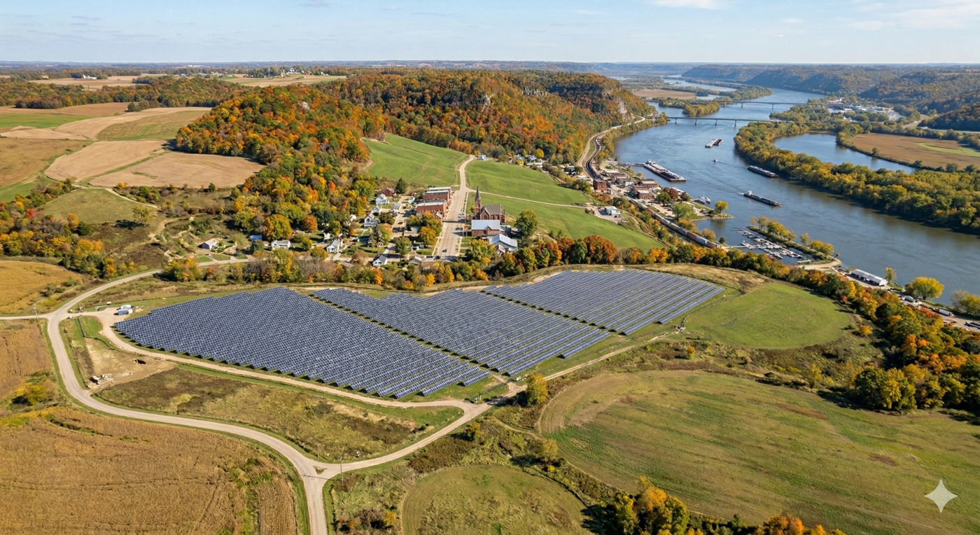
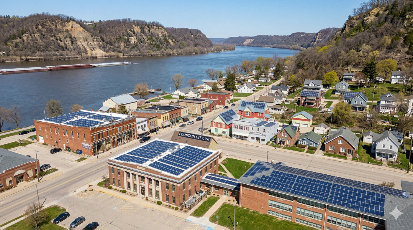
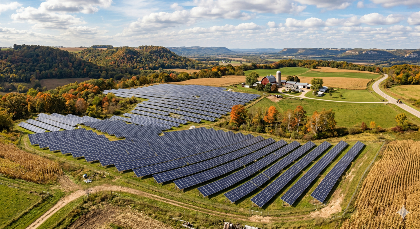
7.9 Solar panels
Solar energy represents a meaningful opportunity for Fountain City to reduce operating costs while demonstrating a commitment to sustainability. Multiple sites could be evaluated for solar installations, including rooftops on city-owned buildings, the railroad-owned property near Fountain City Community Park, and any new municipal infrastructure. A rooftop installation on city buildings would be the most straightforward starting point and could be pursued through a lease arrangement with a solar developer, allowing the city to benefit from generated energy with little upfront investment. Revenue or savings from solar generation could offset operating costs, fund maintenance of public spaces, or support new amenities. State and federal incentive programs are currently available that could substantially reduce installation costs, making this a good time to explore feasibility.
8 Conclusion and next steps
The recommendations in this report share a common thread: making Fountain City a more walkable, connected, and livable place. Whether through trail improvements that link neighborhoods to the riverfront, public spaces that invite people to linger, or streetscape changes that make downtown safer and more welcoming on foot, each proposal reflects the belief that small-scale investments in the public realm can have an outsized impact on community character and economic vitality.
This report is intended as a menu, not a mandate. City staff, elected officials, and community members should feel free to draw from these recommendations selectively by pursuing the projects that align with available funding, volunteer capacity, and local enthusiasm. Some items will be achievable quickly and at low cost; others will require grant funding, partnerships, or multi-year planning. The goal is to provide a broad set of options so that progress can happen continuously, even as priorities and resources shift over time. Many of the projects described here are strong candidates for public grant programs at the federal and state level, and cultivating relationships with regional foundations and local philanthropists can unlock additional support that eases the financial burden on local taxpayers. The city should treat grant-writing and funding development as a standing organizational priority.
After completing the near- and mid-term projects outlined in this report, Fountain City will be well-positioned to pursue broader regional partnerships and a more ambitious public profile. The improvements described here are designed to build on one another, and early successes will create momentum and credibility for larger investments down the road. Looking outward to neighboring communities and regional institutions will be an important part of that next chapter.
8.1 Coordination with surrounding communities
Fountain City and nearby towns host a number of events throughout the year, particularly in the summer and around holidays. These events can be self-defeating when surrounding towns schedule events on the same day, splitting attendance and diluting the economic impact for everyone involved. The city should consider creating a small planning coalition with council members or committee members from nearby towns to coordinate event scheduling on different days. This would help ensure each town’s events are as successful as possible and open the door to wider community participation across the region—turning neighboring towns from inadvertent competitors into collaborators.
8.2 Increase utilization of public facilities by organizations in Winona
Fountain City’s proximity to Winona, Minnesota—a city of roughly 25,000 with two universities—represents an underutilized economic opportunity. With improved facilities and a more vibrant public realm, the city could actively market its parks, ballfields, event spaces, and waterfront to Winona-area organizations, teams, schools, and clubs. A simple outreach effort through Winona’s parks and recreation department, university athletic programs, and community organizations could generate recurring event bookings and a steady stream of visitors who spend money in local businesses. This kind of soft regionalism—building informal relationships with neighboring communities—costs little and can yield meaningful returns.
8.3 Other projects as momentum builds
As the public space improvements described in this report take hold, Fountain City will be positioned to consider more ambitious and longer-horizon investments. A few possibilities are worth tracking as conditions develop:
The lower docks area near the large sand piles is underutilized relative to its potential. As the upper docks are improved and the trail system extends along the waterfront, the lower docks could become a natural next candidate for targeted investment in public access, fishing facilities, or small-scale recreation amenities.
A small bike-share system—even a handful of stations with a modest fleet—could make it easier for visitors without bikes to explore the trail network. Costs for small-community systems have come down significantly, and several turn-key programs are available that require minimal municipal administration.
As the city’s wastewater treatment infrastructure ages toward the end of its useful life, it may be worth exploring a cooperative arrangement with Winona, Minnesota to access regional treatment capacity. While a significant infrastructure commitment, this type of agreement could reduce long-term operating costs and eventually free up the treatment site for other uses.
Tax Incremental Financing (TIF) is a tool that allows municipalities to capture future property tax revenue generated by new development to pay for public improvements in a defined district. Fountain City should approach TIF cautiously—it is most effective when growth conditions are already favorable—but if the public space improvements described here begin to attract private investment, TIF could become a useful financing mechanism for larger downtown infrastructure projects down the road.